2 entries match your criteria.
Related Historical Markers
By Trevor L Whited, May 30, 2023
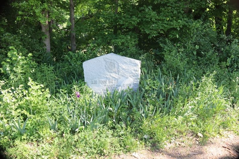
Olde Towne Battle Marker
SHOWN IN SOURCE-SPECIFIED ORDER
| On South Eel River Road, 0.5 miles north of County Road 200N, on the left when traveling east. |
| | Fought Aug. 7, 1791 — — Map (db m224633) WM |
| On County Road E250N, 0.8 miles east of County Road N600E, on the right when traveling east. |
| |
Wilkinson's Expedition. 525 Kentuckians burned Olde Towne: after a skirmish in Bloody Hollow and an Aug. 8. 1791 battle here had killed ten Indians and two soldiers, including John Bartlett; and wounded John Stafford. 34 of the . . . — — Map (db m224655) HM |
May. 18, 2024