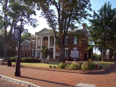
On East Jefferson Street at Park Street, on the right when traveling west on East Jefferson Street.
Three miles to the southeast, Thomas Jefferson began the house in 1770 and finished it in 1802. He brought his bride to it in 1772. Lafayette visited it in 1825. Jefferson spent his last years there and died there, July 4, 1826. His tomb is there. . . . — — Map (db m65069) HM
On Hatton Ferry Road, 0.5 miles south of Hatton Ferry Lane, on the right when traveling south. Reported missing.
Ferries In Virginia
The James, York, Rappahannock and smaller rivers were the primary means of commercial transportation in Virginia until the advent of railroads in the mid-1800’s. In most locations ferries provided the only way to cross . . . — — Map (db m14527) HM
On James River Road (Virginia Route 742) 0.2 miles east of Warren Ferry Road, on the right when traveling east.
Just to the south was Mount Warren, the home of Wilson Cary Nicholas. He served in the Continental army, represented Albemarle County in the General Assembly (1784–1789, 1794–1799), and was a delegate to the Virginia Convention of 1788 . . . — — Map (db m19406) HM
On Irish Road (Virginia Route 6) at James River Road, on the right when traveling west on Irish Road.
Five miles southwest of here is the Hatton Ferry on the James River which began operating in the 1870s. James A. Brown established the ferry and a store on land first rented and then purchased from S.P. Gantt in 1881. In 1883 when a post office was . . . — — Map (db m88501) HM
On Hatton Ferry Road, 0.2 miles south of Hatton Ferry Lane, on the left when traveling south.
James A. Brown began operating a store and ferry at this site on rented property in the late 1870’s. In 1881 he bought the land from S. P. Gantt at which time the store became a stop on the Richmond and Alleghany Railroad. Two years later, Brown was . . . — — Map (db m12882) HM
On James Monroe Parkway (County Route 795) 0.8 miles south of Thomas Jefferson Parkway (Virginia Route 53), on the left when traveling south.
This estate was the home of James Monroe, fifth president of the United States. In 1793, James and Elizabeth Kortright Monroe purchased 1,000 acres adjoining Jefferson’s Monticello. Called Highland, the plantation, eventually totaling 3,500 acres, . . . — — Map (db m23437) HM
On Thomas Jefferson Highway (Virginia Route 53) just east of Milton Road (County Route 732), on the right when traveling east. Reported permanently removed.
The house was built about 1770 by workmen engaged in building Monticello. Mazzei, an Italian, lived here for some years adapting grape culture to Virginia. Baron de Riedesel, captured at Saratoga in 1777, lived here with his family, 1779–1780. . . . — — Map (db m21952) HM
On Scottsville Road (Virginia Route 20) 0.5 miles south of Frys Path (Virginia Route 627), on the right when traveling north.
Built before 1744 by
Col. Joshua Fry
1699-1754
Surveyor, Mathematician, Pioneer
Commander-in-Chief of Virginia Forces
French and Indian War
George Washington Inscribed over his Grave
“Here lies the good, the just
and the noble . . . — — Map (db m23244) HM