2 entries match your criteria.
Related Historical Markers
October 21, 2023
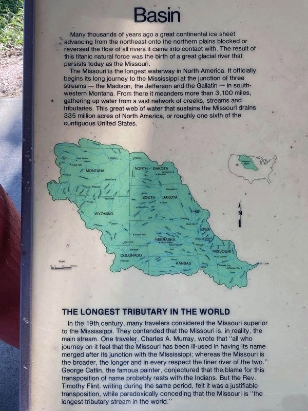
Missouri River Basin section of marker
SHOWN IN SOURCE-SPECIFIED ORDER
| 1 ► South Dakota, Charles Mix County, Pickstown, White Swan Township — Missouri River — |
| Basin Many thousands of years ago a great continental ice sheet advancing from the northeast onto the northern plains blocked or reversed the flow of all rivers it came into contact with. The result of this titanic natural force was the . . . — — Map (db m234980) HM | |||
| 2 ► South Dakota, Gregory County, Pickstown — 20 — Fort Randall — |
| was established by Brig. Gen. W. S. Harney in 1856 and named by him for Col. Daniel Randall, Deputy Paymaster U.S. Army. Construction was started on June 26, 1856 by 1st Lts. George H. Paige, 2nd Inf. and D.S. Stanley, 1st Cavalry, Col. E. Lee 2nd . . . — — Map (db m188367) HM | |||