4 entries match your criteria.
Related Historical Markers
Timmins Heritage Tour
By Cosmos Mariner, June 5, 2022
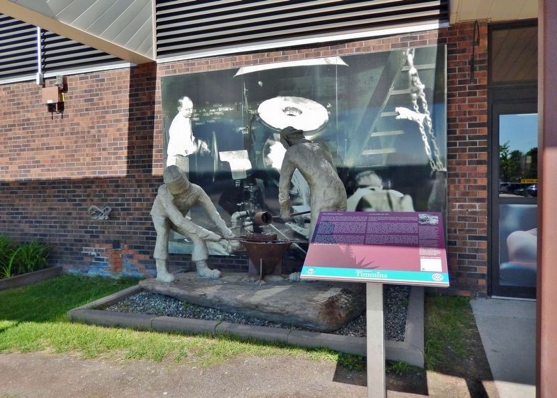
The Refinery Pour / La coulée de l'or Marker
SHOWN IN SOURCE-SPECIFIED ORDER
| On Airport Road, 5.8 kilometers north of Laforest Road, on the right. |
| | [English] Once the ore is mined from the earth, the gold must be removed from the ore. The extraction of gold from ore and refining it into 'pure' gold involves a number of physical and chemical processes that are carried out on an . . . — — Map (db m244417) HM |
| On Main Street at Bloor Avenue, on the left when traveling south on Main Street. |
| | [English] There is no shortage of stories about the prospectors who came north during the Porcupine Gold Rush of 1909. Life was not easy; they carried 75-pound packs through muskeg and uneven ground. Of course nothing was certain . . . — — Map (db m199240) HM |
| On University Street, 0.1 kilometers south of Jubilee Avenue West, in the median. |
| | [English] "Great Rush of men to the Porcupine!" "On to the Porcupine is now the Cry!" Prospectors and speculators came from across the continent to take part in the Porcupine Gold Rush that began in earnest in 1909 with the . . . — — Map (db m244343) HM |
| On Algonquin Boulevard East (Provincial Highway 101) just east of Brunette Road, on the right when traveling east. |
| | [English] Timmins is one of the richest gold producing areas in the world; the Porcupine Gold Rush led to the extraction of well over 65 million ounces of gold to date and by comparison, the Klondike Gold Rush coaxed out just over 5 . . . — — Map (db m244434) HM |
May. 19, 2024