On South Broadway (Pennsylvania Route 512) 0.3 miles north of Male Road (County Road 1028), on the left when traveling north.
Heller's Tavern near Wind Gap was the site for Sullivan's army at the end of the first day's march from Easton, June 18, 1779. The army was astir at 4 the next morning, crossing the mountains at Wind Gap. — — Map (db m29722) HM
On Knox Avenue (Pennsylvania Route 2025) 0 miles west of Sullivan Trail, on the left when traveling north.
This major expedition of the Revolution aimed at the Indian-Tory alliance in New York, was organized at Easton under Gen. John Sullivan. Over a month's preparations preceded the first day's march, begun near here June 18, 1779. — — Map (db m29604) HM
On River Street near South Street, on the right when traveling south.
Built by Pennsylvania, 1771; seized by Connecticut settlers. Rebuilt 1778. Mobilization camp for Sullivan's army, 1779. Destroyed 1784, after withdrawal of the Continental and Pennsylvania garrisons. — — Map (db m18650) HM
On U.S. 20 at Gravel Road (County Route 101), on the left when traveling north on U.S. 20.
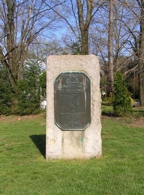
Routes of the armies of
General John Sullivan
and
General James Clinton
1779
An expedition against the hostile Indian nations which checked the aggression of the English and Indians on the frontiers of New York and Pennsylvania, . . . — — Map (db m8069) HM
On Kingdom Plaza (U.S. 20) 0.1 miles west of Balsey Road, on the right when traveling east.
Along north side of river
marched Sullivan’s forces
Expedition commanded by
Col. Peter Gansevoort & Lt. Col. William Butler
Sept. 20-21, 1779 — — Map (db m8197) HM
On West Main Street (U.S. 20) 0.1 miles west of Park Place, on the right when traveling west.
Routes of the armies of
General John Sullivan
and
General James Clinton
1779
An expedition against the hostile Indian nations which checked the aggression of the English and Indians on the frontiers of New York and Pennsylvania, . . . — — Map (db m8193) HM
On U.S. 20, 0.1 miles west of Park Place, on the right when traveling west.
This monument was erected in
September 1879. To commemorate
The destruction of the Indian village
SKOI-YASE,
By Col. John Harper, under orders of
Maj. Gen John Sullivan,
September 8, 1779. — — Map (db m8192) HM