4 entries match your criteria.
Related Historical Markers
To better understand the relationship, study each marker shown.
By Paul Crumlish, April 2, 2010
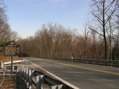
Wide view of the Pilger Ruh Marker
SHOWN IN SOURCE-SPECIFIED ORDER
| On Lancaster Avenue (Pennsylvania Route 501) at Pilger Ruh Road, on the right when traveling north on Lancaster Avenue. |
| | "Pilgrim's Rest" was the name given to this spring on the Tulpehocken Path by Count Zinzendorf, the Moravian missionary, on his journey to the Indian towns of Shamokin and Wyoming in 1742. — — Map (db m29551) HM |
| On Lancaster Avenue (Pennsylvania Route 501) at Schubert Road, on the right when traveling north on Lancaster Avenue. |
| | Fort Henry, built 1756 to guard Lebanon Valley from Delaware and Shawnee raids, stood 3/4 mile northwest of here on the Tulpehocken Path. The trail came over the mt. near where present road cutting is seen. Round Head overlooks it from east. — — Map (db m29542) HM |
| On State Street (State Highway 147), on the right when traveling south. |
| | The Indian Ambassadors Road turned east near here over the hills to the Tulpehocken Valley. Used by Iroquois chiefs from Onondaga, now Syracuse, carrying peace wampum from the "Fire that Never Dies" to Philadelphia. Often traveled by Shickellamy. — — Map (db m14405) HM |
| On State Highway 147, on the right when traveling north. |
| | In 1701, here, John Scull operated a trading post. He was the first known Englishman to visit the Indian village of "Shamokin" and was here as late as 1729. On October 17, 1750 Thomas and Richard Penn executed a deed for this land, including in . . . — — Map (db m14403) HM |
May. 2, 2024