13 entries match your criteria.
Related Historical Markers
Take a tour of the Roadside Exhibits erected on the Battle of Bentonville.
By Bill Coughlin, August 3, 2010
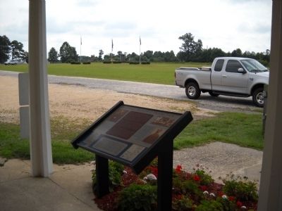
Marker on the Bentonville Battlefield
SHOWN IN SOURCE-SPECIFIED ORDER
| On Harper House Road, 0.1 miles west of Mill Creek Church Road, on the left when traveling east. |
| On Harper House Road, 0.2 miles east of Mill Creek Church Road, on the left when traveling east. |
| On Mill Creek Church Road, on the right when traveling north. |
| Near Mill Creek Church Road, on the right when traveling north. |
| On Harper House Road (County Route 1008), on the left. |
| On Harper House Road (County Route 1008), on the left when traveling east. |
| On Harper House Road (County Route 1008), on the right when traveling east. |
| On Harper House Road (County Route 1008), on the right when traveling east. |
| On Harper House Road (County Route 1008), on the right. |
| On Bass Road (County Route 1008) at Bass Road (County Route 1194), on the left when traveling east on Bass Road. |
| On Westbrook Lowgrounds Road (County Route 1189) at Bentonville Road (County Route 1197), on the right when traveling east on Westbrook Lowgrounds Road. |
| On Westbrook Lowgrounds Road (County Route 1198) at Bentonville Road (County Route 1197), on the right when traveling east on Westbrook Lowgrounds Road. |
| On Westbrook Lowgrounds Road (County Route 1198) at Bentonville Road (County Route 1197), on the right when traveling east on Westbrook Lowgrounds Road. |
May. 4, 2024