Near Sandston in Henrico County, Virginia — The American South (Mid-Atlantic)
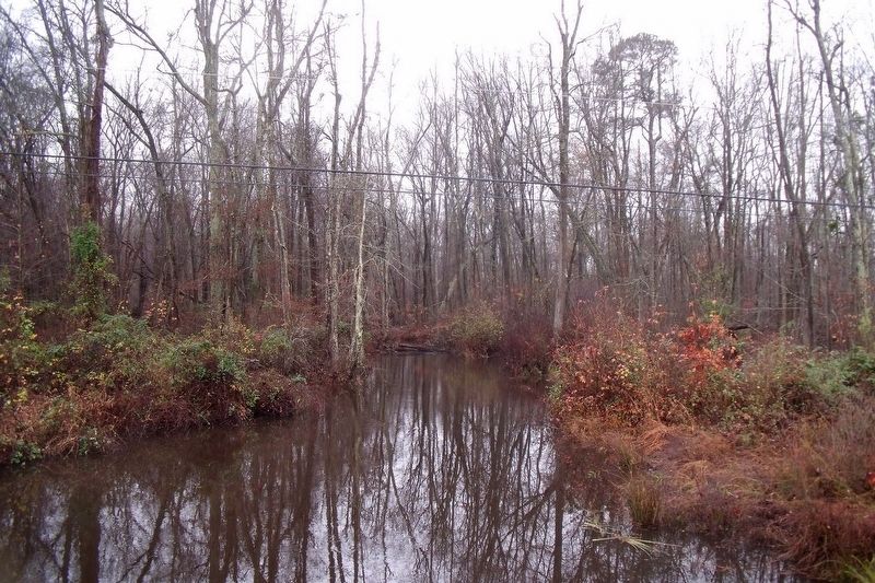
White Oak Swamp
Controversy for Stonewall Jackson
— 1862 Peninsula Campaign —
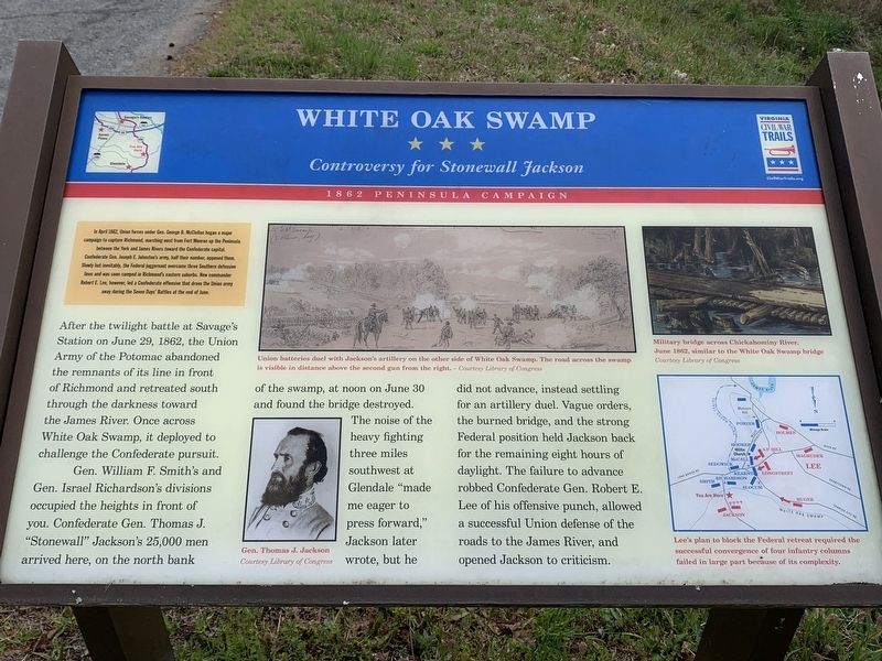
In April 1862, Union forces under Gen. George B. McClellan began a maior campaign to capture Richmond, marching east from Fort Monroe up the Peninsula between the York and James Rivers toward the Confederate capital. Confederate Gen. Joseph E. Johnston's army, half their number, opposed them. SLowly but inevitably, the Federal juggernaut overcame three Southern defensive lines and was soon camped in Richmond's eastern suburbs. New commander Robert E. Lee, however, led a Confederate offensive that drove the Union army away during the Seven Days' Battles at the end of June.
After the twilight battle at Savage's Station on June 29, 1862, the Union Army of the Potomac abandoned the remnants of its line in front of Richmond and retreated south through the darkness toward the James River. Once across White Oak Swamp, it deployed to challenge the Confederate pursuit.
Gen. William F. Smith's and Gen. Israel Richardson's divisions occupied the heights in front of you. Confederate Gen. Thomas J. "Stonewall" Jackson's 25,000 men arrived here, on the north bank of the swamp, at noon on June 30 and found the bridge destroyed. The noise of the heavy fighting three miles southwest at Glendale "made me eager to press forward," Jackson later wrote, but he did not advance, instead settling for an artillery duel. Vague orders, the burned bridge, and the strong Federal position held Jackson back for the remaining eight hours of daylight. The failure to advance robbed Confederate Gen. Robert E. Lee of his offensive punch, allowed a successful Union defense of the roads to the James River, and opened Jackson to criticism.
(captions)
Union batteries duel with Jackson's artillery on the other side of White Oak Swamp. The road across the swamp is visible in distance above the second gun from the right. — Courtesy Library of Congress
Gen. Thomas J. Jackson Courtesy Library of Congress
Military bridge across Chickahominy River, June 1862, similar to the White Oak Swamp bridge Courtesy Library of Congress
Lee's plan to block the Federal retreat required the successful convergence of four infantry columns failed in large part because of its complexity.
Erected by Virginia Civil War Trails.
Topics. This historical marker is listed in this topic list: War, US Civil. A significant historical date for this entry is June 30, 1862.
Location. 37° 28.144′ N, 77° 12.546′ W. Marker is near Sandston, Virginia, in Henrico County. Marker is at the intersection of Elko Road (County Route 156) and Potugee Road, on the right when traveling south on Elko Road. Touch for map. Marker is at or near this postal address: 7091 Elko Rd, Sandston VA 23150, United States of America. Touch for directions.
Other nearby markers. At least 8 other markers are within 2 miles of this marker, measured as the crow flies. A different marker also named White Oak Swamp (a few steps from this marker); Seven Days Battles (approx. 0.4 miles away); a different marker also named Seven Days Battles (approx. 0.7 miles away); Decoy Airfield (approx. 1.4 miles away); Elko Community Center (approx. 1.7 miles away); Riddell's Shop (approx. 2.1 miles away); Glendale (Frayser’s Farm) (approx. 2.1 miles away); a different marker also named Seven Days’ Battles (approx. 2.1 miles away). Touch for a list and map of all markers in Sandston.
Related marker. Click here for another marker that is related to this marker. Old Marker At This Location also titled "White Oak Swamp".
Credits. This page was last revised on April 21, 2022. It was originally submitted on April 21, 2022, by James Dean of Chesterfield, Virginia. This page has been viewed 286 times since then and 73 times this year. Photos: 1. submitted on April 19, 2022, by James Dean of Chesterfield, Virginia. 2. submitted on November 25, 2009, by Bernard Fisher of Richmond, Virginia. • Bernard Fisher was the editor who published this page.

