2 entries match your criteria.
Related Historical Markers
By William Fischer, Jr., February 19, 2011
Council Oak Marker
SHOWN IN SOURCE-SPECIFIED ORDER
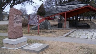
| 1 ► Kansas, Morris County, Council Grove — Council Oak — August 10, 1825 — |
| Under this tree the treaty between the U.S. Commissioners and the Osage Indians was signed giving the right of way forever through their land establishing the Santa Fe Trail — — Map (db m44971) HM | |||
| 2 ► Kansas, Morris County, Council Grove — Council Oak — |
| The hunting grounds of the Kaw (Kansa) and Osage Indians were located here when Americans and Mexicans began hauling trade goods over the Santa Fe Trail in 1821. In 1825, in response to traders and merchants who eagerly sought trade with . . . — — Map (db m44981) HM | |||