Council Grove in Morris County, Kansas — The American Midwest (Upper Plains)
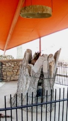
Council Oak
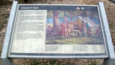
The hunting grounds of the Kaw (Kansa) and Osage Indians were located here when Americans and Mexicans began hauling trade goods over the Santa Fe Trail in 1821.
In 1825, in response to traders and merchants who eagerly sought trade with Mexicans, the U.S. Congress authorized that a road be surveyed and marked from the western frontier of Missouri to New Mexico.
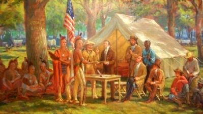
A council was held in this oak grove among U.S. Commissioner George C. Sibley; Pa-hu-ska (White Hair), head chief of the Great Osages; and Ca-he-ga-wa-ton-ega (Foolish Chief), head chief of the Little Osages. On August 10, 1825, they signed a treaty granting passage through Osage territory for citizens of the United States and Mexico in exchange for $800 in cash, plus ribbons, tobacco, calico, and other goods.
Sibley named the site "Council Grove." Traders continued to use the name when referring to the site, and later on, to the small settlemet found here by 1847. The community grew, and the town was incorporated in 1865.
The Kaw (Kansa) Indians were hunting buffalo to the west when the treaty was signed. Sibley caught up with them at Turkey Creek (near present-day McPherson) and signed an identical treaty with them six days later.
Erected by National Park Service and City of Council Grove.
Topics and series. This historical marker is listed in these topic lists: Industry & Commerce • Native Americans • Roads & Vehicles. In addition, it is included in the Historic Trees, and the Santa Fe Trail series lists. A significant historical year for this entry is 1821.
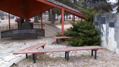
Location. 38° 39.708′ N, 96° 29.051′ W. Marker is in Council Grove, Kansas, in Morris County. Marker is on Main Street (U.S. 56) near 2nd Street, on the left when traveling east. Marker is in Council Oak Park. Touch for map. Marker is at or near this postal address: 106 East Main Street, Council Grove KS 66846, United States of America. Touch for directions.
Other nearby markers. At least 8 other markers are within walking distance of this marker. Council Grove (here, next to this marker); Santa Fe Trail / Council Grove (a few steps from this marker); a different marker also named Council Oak (a few steps from this marker); Company "C" 137th Infantry (a few steps from this marker); Bur Oak (within shouting distance of this marker); a different marker also named Bur Oak (about 400 feet away, measured in a direct line); Post Office Oak (about 600 feet away); Brewery (about 600 feet away). Touch for a list and map of all markers in Council Grove.
Also see . . .
1. Our Rich History. Council Grove Area Trade & Tourism Association website entry (Submitted on July 24, 2011, by William Fischer, Jr. of Scranton, Pennsylvania.)
2. Kaw Nation. Tribe website homepage (Submitted on July 24, 2011, by William Fischer, Jr. of Scranton, Pennsylvania.)
3. Osage Nation. Tribe website homepage (Submitted on July 24, 2011, by William Fischer, Jr. of Scranton, Pennsylvania.)
4. 1825 Treaty with the Great and Little Osage. Kansas Genealogy website entry (Submitted on July 24, 2011, by William Fischer, Jr. of Scranton, Pennsylvania.)
5. 8 Wonders of Kansas History: Council Grove, Santa Fe Trail National Historic Landmark. Kansas Sampler Foundation website entry (Submitted on July 24, 2011, by William Fischer, Jr. of Scranton, Pennsylvania.)
6. Santa Fe National Historic Trail. National Park Service website entry (Submitted on July 24, 2011, by William Fischer, Jr. of Scranton, Pennsylvania.)

Photographed By Unknown, undated
4. Painting on Council Oak Marker
[Caption reads]Three U.S. commissioners were assigned to survey and mark the road to Santa Fe and gain the consent of American Indians whose lands it crossed. Mountain man "Old Bill" Williams served as translator. [Painting is at Kaw Mission State Historic Site]
Credits. This page was last revised on August 23, 2023. It was originally submitted on July 24, 2011, by William Fischer, Jr. of Scranton, Pennsylvania. This page has been viewed 657 times since then and 27 times this year. Photos: 1, 2, 3, 4. submitted on July 24, 2011, by William Fischer, Jr. of Scranton, Pennsylvania.


