7 entries match your criteria.
Related Historical Markers
By TRCP Alliance, September 25, 2011
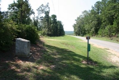
Old Federal Road Marker (South Bound View)
SHOWN IN SOURCE-SPECIFIED ORDER
| On Old Federal Road (County Road 5) south of County Road 42, on the left when traveling south. |
| | Site of Fort Warren, built in 1816 by Colonel Richard Warren, who owned considerable land in this vicinity. This facility was used as a refuge for settlers who feared for their lives in the early days of the aftermath of the Creek Indian Wars of . . . — — Map (db m47689) HM |
| On County Road 5, 0.2 miles south of County Road 37, on the right when traveling south. |
| | Duncan MacMillan’s stage stop was located near here. According to traveler James Stuart in 1830, he (Duncan) “did not taste fermented liquor” and “thought coffee was the best stimulant.” Mr. McMillan came from Scotland and like many early settlers . . . — — Map (db m81278) HM |
| On County Road 5 at County Road 20, on the right when traveling north on County Road 5. |
| | Near Bermuda was the home of Jeremiah Austill, who won fame in the canoe fight on the Alabama River during the Creek Indian War. His first wife, Sarah, died of injuries from falling off a fence during an Indian raid. — — Map (db m81280) HM |
| On County Road 1 at State Route 83, on the right when traveling south on County Road 1. |
| | For a few months between 1811—1818 the nationally infamous highwayman, Joseph Thompson Hare, operated with his gang along the Federal Road. They headquartered at Turk's Cave near Brooklyn in Conecuh County. In his confession he referred to the . . . — — Map (db m81282) HM |
| On Butler Road (County Road 45) 0.1 miles south of Neuschwander Road, on the right when traveling south. |
| |
Coley Chapel is the present day site of the former Town of Hadley.
MacDavid's Hotel was also located here and was recorded by travelers in the 1830's as a hotel which had "plenty of nice pork, which in some shape or other is the food generally . . . — — Map (db m84376) HM |
| On Old Stage Road (County Road 5) 0.1 miles north of Hollinger Road, on the left when traveling north. |
| | John Poebles had an established toll bridge over Little Escambia Creek in the early 1800’s. A dispute over the bridge arose between Poebles and John Hollinger. As a result Hollinger built a toll free bridge adjacent to Poebles’ toll bridge. — — Map (db m84378) HM |
| On Wright Street (County Road 38) 2.6 miles west of South Butler Springs Road (County Road 7), on the right when traveling west. |
| | North of Salem Cemetery and the former church was the site of Price's Hotel, the first place to spend the night on the Federal Road after Greenville. Mr Price was also the stagecoach driver for this section between Greenville and his hotel. Mrs . . . — — Map (db m84986) HM |
May. 3, 2024