2 entries match your criteria.
Related Historical Markers
To better understand the relationship, study the markers shown.
National Park Service, Thomas Stone National Historic Site, January 11, 2019
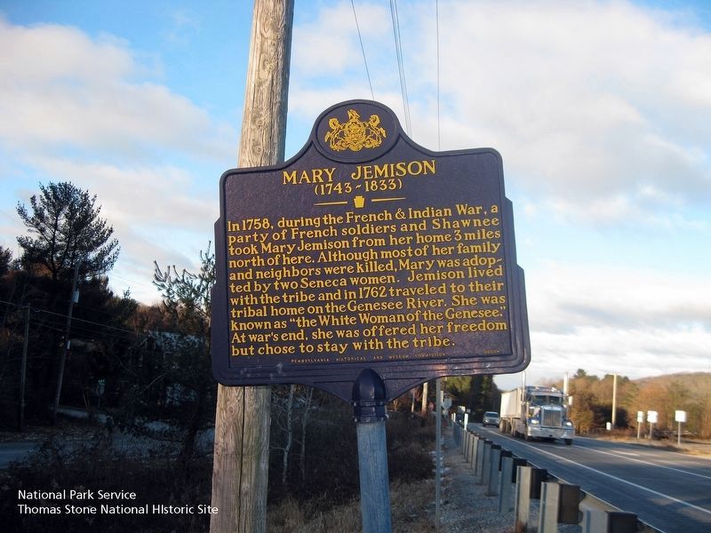
Mary Jemison Marker
SHOWN IN SOURCE-SPECIFIED ORDER
| On Lincoln Highway (U.S. 30) at Buchanan Valley Road (State Route 234), on the right when traveling east on Lincoln Highway. |
| | In 1758, during the French & Indian War, a party of French soldiers and Shawnee took Mary Jemison from her home 3 miles north of here. Although most of her family and neighbors were killed, Mary was adopted by two Seneca women. Jemison lived with . . . — — Map (db m11620) HM |
| Near Governor Thomas E. Dewey Thruway (Interstate 90 at milepost 366), 12.6 miles Interstate 490, on the right when traveling east. |
| | The Genesee River rises in Pennsylvania and flows northward 150 miles before emptying into Lake Ontario. Starting as a placid stream, the Genesee, in Letchworth State Park, plunges over three impressive cataracts, dropping 300 feet in three miles. . . . — — Map (db m57085) HM |
May. 7, 2024