Marker Logo HMdb.org THE HISTORICAL
MARKER DATABASE
“Bite-Size Bits of Local, National, and Global History”


5 entries match your criteria.  


Related Historical Markers

 
Mission Neosho Marker image, Touch for more information
By Ryan Purcell, March 22, 2015
Mission Neosho Marker
SHOWN IN SOURCE-SPECIFIED ORDER
1 Kansas, Neosho County, Erie — 52 — Mission Neosho
On Pratt Road (U.S. 59) at 160th Road (Kansas Highway 146), on the right when traveling north on Pratt Road.
2 Missouri, Bates County, Rich Hill — 33 — Harmony MissionAmerican Presbyterian and Reformed Historical Site No. 33
On Walnut Street (State Highway A) at 13th Street, on the right when traveling east on Walnut Street.
3 Kansas, Montgomery County, Independence — 56 — Drum Creek and the Civil War
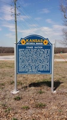
On Main Street (U.S. 160) at 4410th Street, on the left when traveling east on Main Street.
4 Missouri, Vernon County, Fair Haven — Osage Sites in the Area
5 Oklahoma, Osage County, Pawhuska — Pawhuska"The Osage Tribe of Indians"
On East Main Street (U.S. 60) at Lynn Avenue (U.S. 60), on the left when traveling west on East Main Street.


CeraNet Cloud Computing sponsors the Historical Marker Database.
This website earns income from purchases you make after using our links to Amazon.com. We appreciate your support.
Paid Advertisement
May. 21, 2024