Parkers Crossroads in Henderson County, Tennessee — The American South (East South Central)
"Charge Them Both Ways"
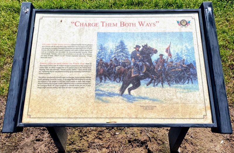
Just when victory seemed certain, Colonel Charles Carroll galloped up to Forrest with the news that a large Union force was fast approaching their rear along the Lexington-Huntington Road and was deploying in line of battle. Forrest, who had left McLemore's battalion with orders to guard against just such and eventuality, was astounded. He recovered quickly, however. When Carroll asked, "General, a heavy line of infantry is in our rear. We're between two lines of battle. What'll we do?" Forrest responded decisively, "Charge them both ways!"
Forrest urged his horse toward the Parker house where he discovered Colonel John W. Fuller's troops in possession of the orchard and nearby field. An officer stopped him as he passed close to the Federal lines, shouting, "Halt and surrender." Forrest quickly replied, "I have already done so," explaining that he was prepared to bring up his remaining command for a formal surrender.
The officer, satisfied with Forrest's reply, let him pass. Forrest quickly wheeled south, galloping toward his cavalry, As he passed the field hospital he warned the surgeons of the danger so that they could prepare to make their escape. When he reached his brigade Forrest ordered his men to remount and head for the Lexington Road. He wasn't prepared to concede defeat just yet. A bold charge might save his artillery and allow his men to escape to safety.
Erected by Parker's Crossroads Battlefield Association.
Topics. This historical marker is listed in this topic list: War, US Civil.
Location. 35° 47.725′ N, 88° 23.358′ W. Marker is in Parkers Crossroads, Tennessee, in Henderson County. Marker can be reached from Tennessee Route 22, 0.6 miles north of Interstate 40, on the right when traveling north. Marker is on the North Loop Trail at Tour Stop 1, Parkers Crossroads City Park. Touch for map. Marker is in this post office area: Wildersville TN 38388, United States of America. Touch for directions.
Other nearby markers. At least 8 other markers are within walking distance of this marker. Flight to Safety (within shouting distance of this marker); Fuller's Assault (within shouting distance of this marker); "Give 'Em Hell" (within shouting distance of this marker); Forrest's Tactics (about 300 feet away, measured in a direct line); Parker's Cross Roads (about 400 feet away); Forrest's West Tennessee Raid (about 400 feet away); The Battle of Parker's Crossroads (about 400 feet away); Morton's Battery (about 400 feet away). Touch for a list and map of all markers in Parkers Crossroads.
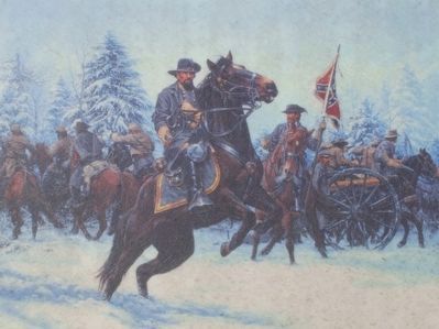
More about this marker. The marker includes a painting "Forrest at Parker's Crossroads by John Paul Strain (courtesy of the artist)
Regarding "Charge Them Both Ways". Around 2016, the "Charge Them Both Ways" field between the Wildersville Road and Interstate 40, was opened to the public and provided with trails and interpretive markers. As of June 2017, none of these markers has been added to HMDB but a better understanding of the charge is now possible.
Related markers. Click here for a list of markers that are related to this marker. To better understand the relationship, study each marker in the order shown.
Also see . . .
1. Parker's Crossroads Battlefield. Association website homepage (Submitted on March 7, 2013, by David Graff of Halifax, Nova Scotia.)
2. Preservation of the "Charge Them Both Ways" Field. At the time of the visit, the land where the charge occurred was not accessible. In 2011, the Civil War Trust acquired the property, one of the last unpreserved sections of the battlefield. It is anticipated that the land where the charge occurred may soon be interpreted and examined up close. (Submitted on February 6, 2014, by David Graff of Halifax, Nova Scotia.)
Additional keywords. Parkers Crossroads

Photographed By David Graff, April 24, 2012
3. Looking Southwest from the "Charge Them Both Ways" Marker
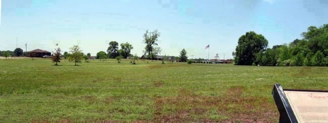
This view looks southwest toward the area where Forrest's charge started and ended. The action occurred beyond the Wildersville Road where the nearest buildings are seen. (The brown building on the left is the Post Office.) The site of the Parker House and the crossroads was just beyond the replanted orchard seen here. A closer view of the charge field is seen in Photo #3.

Photographed By David Graff, April 24, 2012
5. Closer View of Forrest's "Both Ways" Charge Field
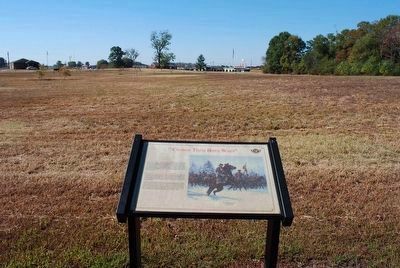
This panorama looks south from the Wildersville Road (previously Pleasant Exchange Road) toward the field of Forrest's Charge. It was taken about 1300 feet southeast of the marker. As of April 2012, there are no trails or interpretation on the field of the charge.
While Forrest's main force that had surrounded Dunham's Union brigade began retreating south toward Lexington, Forrest with about 75 to 100 cavalry troopers, began a charge from near McDonald's Restaurant (red roof at extreme right) and raced through an open field following the route of Interstate 40 (in front of the distant tree line). Reaching a point just off the right of this view and southeast of Jones Cemetery (Tour Stop 4), his troopers reversed direction and attacked the flank of Fuller's 27th Ohio with the 7th Wisconsin Battery taking their horses. This would have been beside or south of the Wildersville Road near this location. Forrest's charge continued west disrupting Fuller's 63rd and 39th Ohio regiments. Finally they turned south on the Lexington-Huntingdon Road (near McDonald's Restaurant) and followed the main Confederate cavalry force south.
While Forrest's main force that had surrounded Dunham's Union brigade began retreating south toward Lexington, Forrest with about 75 to 100 cavalry troopers, began a charge from near McDonald's Restaurant (red roof at extreme right) and raced through an open field following the route of Interstate 40 (in front of the distant tree line). Reaching a point just off the right of this view and southeast of Jones Cemetery (Tour Stop 4), his troopers reversed direction and attacked the flank of Fuller's 27th Ohio with the 7th Wisconsin Battery taking their horses. This would have been beside or south of the Wildersville Road near this location. Forrest's charge continued west disrupting Fuller's 63rd and 39th Ohio regiments. Finally they turned south on the Lexington-Huntingdon Road (near McDonald's Restaurant) and followed the main Confederate cavalry force south.
Credits. This page was last revised on February 28, 2022. It was originally submitted on March 6, 2013, by David Graff of Halifax, Nova Scotia. This page has been viewed 1,030 times since then and 39 times this year. Last updated on March 17, 2014, by David Graff of Halifax, Nova Scotia. Photos: 1. submitted on May 30, 2021, by Shane Oliver of Richmond, Virginia. 2. submitted on August 22, 2015, by Brandon Fletcher of Chattanooga, Tennessee. 3. submitted on March 6, 2013, by David Graff of Halifax, Nova Scotia. 4. submitted on August 22, 2015, by Brandon Fletcher of Chattanooga, Tennessee. 5. submitted on March 6, 2013, by David Graff of Halifax, Nova Scotia. • Bernard Fisher was the editor who published this page.


