Near Floresville in Wilson County, Texas — The American South (West South Central)
Vicinity of Site: "Mision de las Cabras"
("Mission of the Goats")
Inscription.
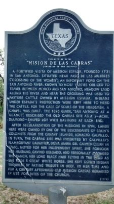
A fortified visita of Mission Espada, founded 1731 in San Antonio. Situated near Paso de las Mujeres ("Crossing of the Women"), an important ford on the San Antonio River, known to most parties obliged to travel between Mexico and San Antonio. Meadowland along the river and near the crossing was used to pasture cattle owned by Mission Espada. Indians under Espada's protection were kept here to herd the cattle. For the care of souls of the herdsmen, a chapel was built. The 1895 guide, "San Antonio at a Glance", described the Old Cabras site as a 2-acre, diamond-shaped lot with bastions at each end.
After secularization of the missions in 1794, lands here were owned by one of the descendants of Spain's colonists from the Canary Islands, Ignacio Calvillo. In turn, the Cabras site was inherited by Calvillo's flamboyant daughter, Dona Maria del Carmen (born in 1765). Noted for her independent spirit, she forsook her husband, Gavino Delgado, and personally managed the ranch, her long black hair flying in the wind as she rode a great white horse. She kept down Indian troubles by paying tribute in beef. In her time and for a century afterward Old Mission Cabras remained in use for rites of the Church.
Erected 1970 by State Historical Survey Committee. (Marker Number 7.)
Topics. This historical marker is listed in these topic lists: Churches & Religion • Hispanic Americans • Settlements & Settlers. A significant historical year for this entry is 1731.
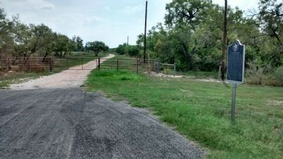
Location. 29° 6.515′ N, 98° 10.525′ W. Marker is near Floresville, Texas, in Wilson County. Marker is at the intersection of State Highway 97 and County Road 132, on the left when traveling south on State Highway 97. Touch for map. Marker is at or near this postal address: 2542 County Rd 132, Floresville TX 78114, United States of America. Touch for directions.
Other nearby markers. At least 8 other markers are within 2 miles of this marker, measured as the crow flies. The Site of the Mission of Las Cabreras (approx. 1.1 miles away); Site of Old Town: Lodi (approx. 1.9 miles away); Wilson County (approx. 2 miles away); James Charles Wilson (approx. 2 miles away); The Flores de Abrego Family and Floresville (approx. 2 miles away); Wilson County Courthouse (approx. 2 miles away); White House Café and Saloon (approx. 2 miles away); Captain Will Wright (approx. 2.1 miles away). Touch for a list and map of all markers in Floresville.
Related marker. Click here for another marker that is related to this marker. Dona Maria del Carmen, referenced on this marker is buried at the nearby Cemetery of the Canary Islanders
Also see . . .
1. Rancho de las Cabras. Texas Beyond History article. Describes archaeological work that has been done at the site. (Submitted on September 24, 2014, by Richard Denney of Austin, Texas.)
2. Rancho de las Cabras - The Handbook of Texas Online. Texas State Historical Association (TSHA) (Submitted on April 9, 2019, by Brian Anderson of Humble, Texas.)
Credits. This page was last revised on December 7, 2022. It was originally submitted on September 24, 2014, by Richard Denney of Austin, Texas. This page has been viewed 822 times since then and 31 times this year. Last updated on December 6, 2022, by Dave W of Co, Colorado. Photos: 1, 2. submitted on September 24, 2014, by Richard Denney of Austin, Texas. • Devry Becker Jones was the editor who published this page.

