Porter in Niagara County, New York — The American Northeast (Mid-Atlantic)
British Forces Landed at Mouth of 4 Mile Creek
Inscription.
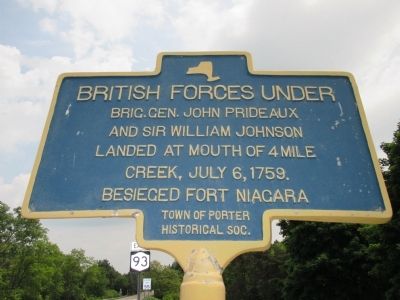
British forces under Brig. Gen John Prideaux and Sir William Johnson landed at mouth of 4 Mile Creek, July 6, 1759. Besieged Fort Niagara.
Erected by Town of Porter Historical Soc.
Topics. This historical marker is listed in this topic list: War, French and Indian. A significant historical date for this entry is July 6, 1759.
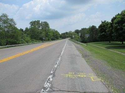
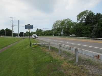
Location. 43° 15.479′ N, 79° 0.501′ W. Marker is in Porter, New York, in Niagara County. Marker is at the intersection of Lockport Street (New York State Route 93) and Creek Road (New York State Route 18), on the right when traveling east on Lockport Street. Marker is just east of the intersection before the bridge over fourmile creek. Touch for map. Marker is in this post office area: Youngstown NY 14174, United States of America. Touch for directions.
Other nearby markers. At least 8 other markers are within 3 miles of this marker, measured as the crow flies. Fort Niagara's P.O.W. Camp (approx. 2.1 miles away); POW Camp - WW II (approx. 2.1 miles away); St. John's Episcopal Church (approx. 2.1 miles away); Betsy Doyle (approx. 2.1 miles away); Site of Salt Battery (approx. 2.1 miles away); The Battle of La Belle Famille (approx. 2.1 miles away); Capture of Fort George (approx. 2.1 miles away); The Site of El Dorado Hotel (approx. 2.2 miles away).
More about this marker . Four Mile Creek is a New York State Park. The mouth of the creek, on Lake Ontario, is four miles east of the Niagara River and Fort Niagara.
Related marker. Click here for another marker that is related to this marker. Prideaux's Flotilla
Also see . . .
1. Battle of Fort Niagara. Wikipedia (Submitted on July 15, 2014, by Anton Schwarzmueller of Wilson, New York.)
2. Four Mile Creek State Park. New York State Office of Parks, Recreation & Historic Preservation website entry (Submitted on July 15, 2014, by Anton Schwarzmueller of Wilson, New York.)
Credits. This page was last revised on January 2, 2022. It was originally submitted on July 15, 2014, by Anton Schwarzmueller of Wilson, New York. This page has been viewed 640 times since then and 32 times this year. Last updated on December 14, 2014, by Anton Schwarzmueller of Wilson, New York. Photos: 1, 2, 3. submitted on July 15, 2014, by Anton Schwarzmueller of Wilson, New York. • Bill Pfingsten was the editor who published this page.


