St. Simons Island in Glynn County, Georgia — The American South (South Atlantic)
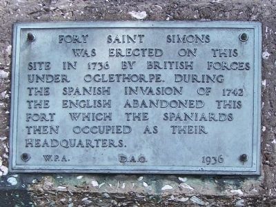
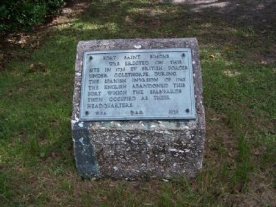
Fort Saint Simons
site in 1736 by British Forces
under Oglethorpe. During
the Spanish invasion of 1742
the English abandoned this
fort which the Spaniards
then occupied as their
headquarters.
W.P.A. D.A.C. 1936
Erected 1936 by Works Progress Administration.
Topics and series. This historical marker is listed in these topic lists: Colonial Era • Forts and Castles • Notable Places. In addition, it is included in the Works Progress Administration (WPA) projects series list. A significant historical year for this entry is 1736.
Location. 31° 8.13′ N, 81° 23.283′ W. Marker is on St. Simons Island, Georgia, in Glynn County. Marker is on Ocean Blvd near 8th St., on the right when traveling east. Touch for map. Marker is in this post office area: Saint Simons Island GA 31522, United States of America. Touch for directions.
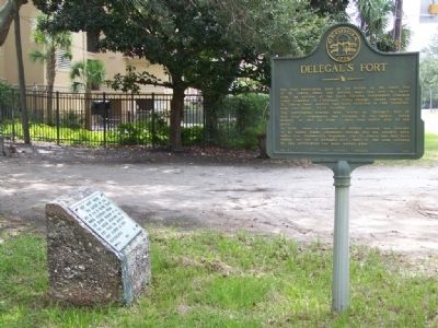
Other nearby markers. At least 8 other markers are within walking distance of this marker. Delegal's Fort (here, next to this marker); Old Spanish Garden (about 700 feet away, measured in a direct line); Welcome to St. Simons Light! (approx. 0.3 miles away); Couper's Point (approx. 0.3 miles away); Fort St. Simons (approx. 0.3 miles away); Keepers of the Light (approx. 0.3 miles away); a different marker also named Fort St. Simons (approx. 0.3 miles away); Historic St. Simons Lighthouse (approx. 0.3 miles away). Touch for a list and map of all markers in St. Simons Island.
Regarding Fort Saint Simons. On the afternoon of July 5th, 1742, a mighty Spanish fleet attacked with the incoming tide, fighting its way furiously through the thin gauntlet of British ships and the cannon of Fort St. Simons. After fierce fighting, often hand-to-hand as the Spanish unsuccessfully attempted to board several British ships, the Spanish fleet anchored in St. Simons Sound and began landing troops a mile and a half northwest of the fort. As the Spanish were landing, Oglethorpe evacuated the southern end of St. Simons Island. After spiking the cannon, destroying equipment and burning the boats too damaged to escape to South Carolina, the soldiers retreated with their families up the Military Road northward to Frederica.
Also see . . . Site of Fort St. Simons, Georgia. Explore Southern History entry (Submitted on October 10, 2020, by Larry Gertner of New York, New York.)
Credits. This page was last revised on November 23, 2020. It was originally submitted on October 7, 2008, by Mike Stroud of Bluffton, South Carolina. This page has been viewed 1,746 times since then and 25 times this year. Photos: 1, 2, 3. submitted on October 7, 2008, by Mike Stroud of Bluffton, South Carolina. • Bill Pfingsten was the editor who published this page.


