5 entries match your criteria.
Related Historical Markers
Markers in Fort Covington, NY, formerly French Mills, to where American forces retreated.
By Anton Schwarzmueller, November 9, 2014
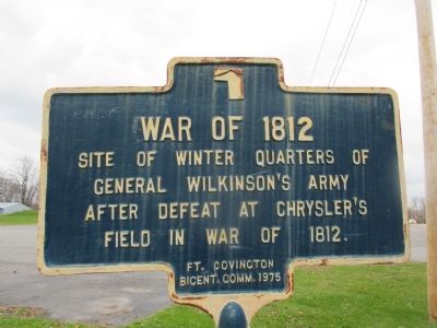
War of 1812 Marker
SHOWN IN SOURCE-SPECIFIED ORDER
| On Chateaugay Street (New York State Route 37) 0.1 miles east of County Route 42, on the left when traveling west. |
| On Salmon Street, 0.2 miles north of Chateaugay Street (New York State Route 37), on the right when traveling north. |
| On Center Street, 0.2 miles west of Water Street, on the right when traveling west. |
| On Chateaugay Street (New York State Route 37) 0.1 miles east of County Route 42, on the left when traveling west. |
| On Chateaugay Street (New York State Route 37) 0.1 miles east of County Route 42, on the right when traveling east. |
May. 3, 2024