On Battle Avenue, on the right when traveling east.
During the Battle of White Plains, the Americans under General Washington were forced off Chatterton’s Hill after inflicting heavy casualties on British troops, checking their advance into Westchester.
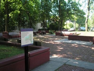
Revolutionary War Heritage Trail — — Map (db m8310) HM
On Battle Avenue, on the right when traveling east.
The American Revolutionary War
1776 2001
Phases of Action
October 28th
Morning
1. Americans Occupy Chatterton’s Hill
2. British Approach from the South
3. American Pickets Retreat
4. Hessians Under Rahl Seize Hill
5. British . . . — — Map (db m8309) HM
On Battle Avenue at Jefferson Avenue, on the right when traveling east on Battle Avenue.
October 28th, 1776 The Continental Army Under the Command of General George Washington Defended the Heights Checking the British Advance Across Westchester
Erected by the City of White Plains to commemorate the 225th Anniversary of the Battle . . . — — Map (db m8298) HM
On Battle Avenue, on the right when traveling east.
Commanded by General George Washington Numbered about 14,500 Men fit for Duty,
Consisting of Continentals From Maryland, Delaware, Connecticut, Pennsylvania and New York, and Militiamen From Several Provinces.
Many of These Units Had . . . — — Map (db m8307) HM
On Whitney Street, on the left when traveling south.
Commanded by General William Howe Numbered about 13,000 Including Several Brigades. The Regiments of Foot Deployed Light Infantry, Chasseurs, and Grenadiers. Artillery Batteries and Light Cavalry Supported Them. The Hessian Battalions Under . . . — — Map (db m237147) HM
On Whitney Street at Battle Avenue, on the left when traveling south on Whitney Street.
General George Washington Commander In Chief of the Continental Army
Erected by the City of White Plains to commemorate the 225th Anniversary of the Battle
Back of Marker:
The Continental Army
Under the command of General George . . . — — Map (db m8303) HM
On Main Street (New York State Route 119), on the right when traveling east.
Near this spot, the British under Howe, forded the Bronx River and attacked the right wing of Washington’s Army located above on Chatterton Hill.
Erected by Act of Congress May 18, 1926.
Side of Monument:
This bowlder was taken from . . . — — Map (db m8295) HM
On N Broadway (New York State Route 22), on the right when traveling south.
The center of Washington’s Army was located here from Oct. 28 to Oct. 31 1776 during the operations around White Plains.Erected by Act of Congress May 18, 1926
( upper marker )
This mortar and this remnant of the revolutionary . . . — — Map (db m189473) HM