3 entries match your criteria.
Related Historical Markers
By Mark Hilton, December 11, 2013
Slave Transportation to Montgomery Marker (side 2)
SHOWN IN SOURCE-SPECIFIED ORDER
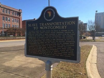
| On Commerce Street at Water Street, on the left when traveling north on Commerce Street. |
| | Side 1
The Domestic Slave Trade
Beginning in the seventeenth century, millions of African people were kidnapped, sold into slavery, and shipped to the Americas as part of the Transatlantic Slave Trade. In 1808, the United States . . . — — Map (db m86427) HM |
| On Commerce Street, 0.1 miles north of Bibb Street (Alabama Route 108), on the right when traveling north. |
| | The Montgomery Slave Trade
Montgomery had grown into one of the most prominent slave trading communities in Alabama by 1860. At the start of the Civil War, the city had a larger slave population than Mobile, New Orleans, or Natchez, . . . — — Map (db m70715) HM |
| On North Royal Street, 0.1 miles St Anthony Street, on the right when traveling south. |
| | After the abolition of international slave trading in 1808, dealers transported slaves from all over the South into Mobile. On this site, Africans were sold as chattel to southern planters through public auction. Between auctions, a three-story . . . — — Map (db m86312) HM |
May. 18, 2024