Marker Logo HMdb.org THE HISTORICAL
MARKER DATABASE
“Bite-Size Bits of Local, National, and Global History”


6 entries match your criteria.  


Related Historical Markers

Virtual Tour by Markers of the Battle of Corydon
 
Presbyterian Church image, Touch for more information
By Ginger Drenning, July 16, 2008
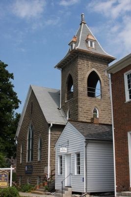
Presbyterian Church
SHOWN IN SOURCE-SPECIFIED ORDER
1 Indiana, Harrison County, Corydon — 31.1965.4 — Presbyterian Church
On East Walnut Street at North Elm Street, on the right when traveling west on East Walnut Street.
2 Indiana, Harrison County, Corydon — 31.1961.1 — Battle of Corydon- - - July 9, 1863 - - -
On North Capitol Avenue, on the right when traveling north.
3 Indiana, Harrison County, Corydon — 31.1963.1 — Site of the Battle of Corydon
On Old Indiana 135 south of West Heidelberg Road NW, on the left when traveling south.
4 Indiana, Harrison County, Corydon — Arville L. Funk1929-1990
On Old Indiana 135, on the right when traveling south.
5 Indiana, Harrison County, Corydon — Morgan's Confederate DeadMorgan's Raid in Harrison County (Indiana)
On Old Indiana 135, 0.1 miles south of West Heidleberg Road.
6 Indiana, Harrison County, Corydon — Battle of Corydon
Near Old Indiana 135 south of W. Heidelberg Rd. NW, on the right when traveling south.
 
 
CeraNet Cloud Computing sponsors the Historical Marker Database.
This website earns income from purchases you make after using our links to Amazon.com. We appreciate your support.
Paid Advertisement
May. 17, 2024