On South Washington Street (U.S. 29) 0.1 miles south of Tinner Hill Road, on the left when traveling north.
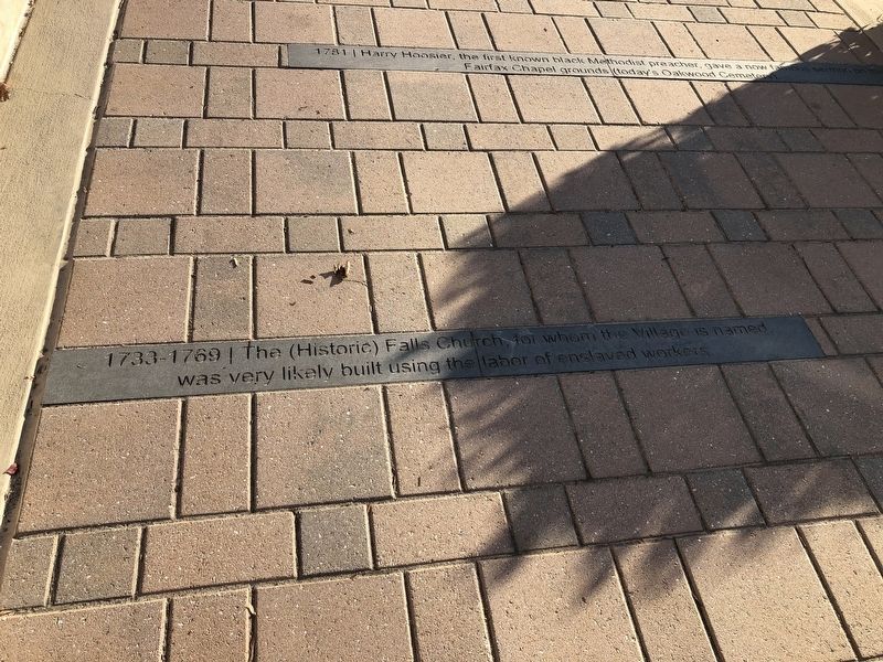
Harry Hoosier, the first known black Methodist preacher, gave a now famous sermon on the Fairfax Chapel grounds (today's Oakwood Cemetery). — — Map (db m186968) HM
On South Washington Street (U.S. 29) just south of Tinner Hill Road, on the left when traveling north.
Early black families in the area included Brice, Wade, Barnett, Jackson, Clay, Gilliam, Honesty, Hall, Scipio, Gaskins, Richardson, Rector, Deskins, Denny, Sims, and others. — — Map (db m186984) HM
On South Washington Street (U.S. 29) 0.1 miles south of Tinner Hill Road, on the left when traveling north.
Harriet Foote Turner, a free black woman, led 12 enslaved people to freedom. In 1867, she owned 7 acres, including the land on which you stand. — — Map (db m186971) HM
On South Washington Street (U.S. 29) just south of Tinner Hill Road, on the left when traveling north.
Philadelphia Quaker abolitionist Emily Howland supported efforts in Falls Church to operate a school for black people before, during, and after the Civil War. — — Map (db m186972) HM
On South Washington Street (U.S. 29) just south of Tinner Hill Road, on the left when traveling north.
John Read and daughter Betsy secretly taught classes for black poeple even though it was against the law. Attendance put students and teachers in danger. — — Map (db m186973) HM
On South Washington Street (U.S. 29) just south of Tinner Hill Road, on the left when traveling north.
Local black men, including Charles Tinner, Isaac Payton, and others joined the Home Guard, an interracial militia protecting the Village. — — Map (db m186976) HM
On South Washington Street (Route 29) just south of Tinner Hill Road, on the left when traveling north.
Mosby's Confederate raiders killed Frank Brooks, a black man, kidnapped John Read, and his black companion, Jacob Jackson. Read, believed to be a Union spy, was executed. Jackson though wounded survived. — — Map (db m186977) HM
On South Washington Street (U.S. 29) just south of Tinner Hill Road, on the left when traveling north.
Some white landowners would not sell to black people or price gouged. Daniel Minor and John S. Crocker sold land at fair prices. Harriet Brice and Fred Foote, Sr. were the first black landowners in the Village. — — Map (db m186979) HM
On South Washington Street (Route 29) just south of Tinner Hill Road, on the left when traveling north.
Falls Church became a town. Frederick Foote, Jr. was elected Town constable and was the first black person on the Town Council (1880). Foote, George Thomas, and Eliza Henderson owned businesses patronized by black and white customers. — — Map (db m186983) HM
On South Washington Street (U.S. 29) just south of Tinner Hill Road, on the left when traveling north.
The Democratic Town council voted to cede one third of the Town to Fairfax County, eliminating an area of potentially powerful black Republican voters. — — Map (db m186989) HM
On South Washington Street (U.S. 29) just south of Tinner Hill Road, on the left when traveling north.
To meet civic and social needs, community members created organizations: House of Ruth, Mothers Council, King Tyre Masonic Lodge #292, Grand United Order of Odd Fellows, Buena Vista Social Club. — — Map (db m187015) HM
On South Washington Street (U.S. 29) just south of Tinner Hill Road, on the left when traveling north.
Dr. E.B. Henderson introduced basketball to African Americans to help break down racial barriers. In 2013, he was inducted into the National Basketball Hall of Fame. — — Map (db m186992) HM
On South Washington Street (U.S. 29) just south of Tinner Hill Road, on the left when traveling north.
William Henderson, a black man, filed a lawsuit after he was illegally thrown from the Falls Church trolley. Local white Attorney Jacob DePutron's testimony helped win his lawsuit. — — Map (db m186993) HM
On South Washington Street (U.S. 29) just north of Tinner Hill Road, on the left when traveling north.
The Falls Church Town Council proposed as residential segregation ordinance requiring that all black people live in specific, confined areas of town. — — Map (db m187004) HM
On South Washington Street (U.S. 29) just south of Tinner Hill Road, on the left when traveling north.
E.B. Henderson and Joseph Tinner convened a meeting at the Joseph and Mary Tinner home to protest the segregation ordinance. The Colored Citizens Protective League was founded by nine men. — — Map (db m187006) HM
On South Washington Street (U.S. 29) just south of Tinner Hill Road, on the left when traveling north.
Joseph Tinner, an oustanding orator who served as spokesperson in community discrimination disputes, was elected first CCPL president. — — Map (db m187007) HM
On South Washington Street (U.S. 29) just west of Tinner Hill Road, on the left when traveling north.
CCPL filed suit in Fairfax County Circuit Court stopping enforcement of the ordinance and gaining their first civil rights victory. — — Map (db m187009) HM
On South Washington Street just south of Tinner Hill Road, on the left when traveling north.
The U.S. Supreme Court ruled, in Warley vs. Buchanan, that residential segregation districts are unconstitutional, nullifying the Falls Church ordinance. — — Map (db m187011) HM
On South Washington Street (U.S. 29) just south of Tinner Hill Road, on the left when traveling north.
African American teachers, Mary Ellen Henderson and Lola Saunders, taught at the overcrowded two-room wooden county schoolhouse, the only school in the area for black children. — — Map (db m187022) HM
On South Washington Street (U.S. 29) just south of Tinner Hill Road, on the left when traveling north.
Though Mary Ellen Henderson and Ollie Tinner spent 20 years lobbying for a new school for black children, it was Henderson's published study that proved the disparity in spending on black and white schools. — — Map (db m187023) HM
On South Washington Street (U.S. 29) just south of Tinner Hill Road, on the left when traveling north.
Black children from Falls Church were sent to segregated schools in Fairfax County which ended at 7th grade. Students traveled to Manassas, VA or Washington, DC for high school. — — Map (db m187020) HM
On South Washington Street (Route 29) just south of Tinner Hill Road, on the left when traveling north.
A profiteering group of white businessmen built Lee Highway through the thriving black community and dissected black-owned properties. — — Map (db m187013) HM
On South Washington Street (U.S. 29) just south of Tinner Hill Road, on the left when traveling north.
Falls Church Town became a City. Black residents started businesses: Blossom Inn, Annie's Dress Shop, Francis Jackson's Beauty Salon, Smitty's Barber Shop, Tinner Well Digging, Deskins Plumbing. — — Map (db m187018) HM
On South Washington Street (U.S. 29) just south of Tinner Hill Road, on the left when traveling north.
The African American community launched letter-writing campaigns and picketed to protest segregated businesses. Ciy businesses integrated without incidents. A cross was burned on the Henderson lawn. Hate mail attributed to the KKK was sent to homes . . . — — Map (db m187028) HM
On South Washington Street (Route 29) just south of Tinner Hill Road, on the left when traveling north.
Falls Church black activists included Claudis Brown, Audrey Williams, Joseph Tinner, Viola Hudson, Mary Ellen Henderson, E.B. Henderson, and Reverends Powell, Costner, and Colbert. — — Map (db m187030) HM
On South Washington Street (U.S. 29) just south of Tinner Hill Road, on the left when traveling north.
Emboldened by school desegregation in Arlington, Falls Church City Public Schools followed suit. The first children to integrrate were from the Costner, Lindsey, and Byrd families. — — Map (db m187026) HM
On South Washington Street (U.S. 29) just south of Tinner Hill Road, on the left when traveling north.
Early civil rights battles in the Town of Falls Church centered on basic rights, equality in education, city services, voting rights, and public transportation. — — Map (db m186990) HM
On South Washington Street (U.S. 29) just south of Tinner Hill Road, on the left when traveling north.
Hiram Read, white pastor of Columbia Baptist, encouraged black worshipers to organize their own church. Second Baptist (1870) and Galloway United Methodist (1867) churches still exist. — — Map (db m186985) HM
On South Washington Street (U.S. 29) 0.1 miles south of Tinner Hill Road, on the left when traveling north.
By 1860, approximately 250 free and enslaved black people lived here. They built a strong black community. Some escaped to freedom, others were freed. Many defied prohibitions to learn reading and writing. — — Map (db m186970) HM
On South Washington Street (U.S. 29) just south of Tinner Hill Road, on the left when traveling north.
In the early 20th century, African Americans in Falls Church addressed inequities and discrimination through legal means. The black community prospered socially and in civic life. — — Map (db m187001) HM
On South Washington Street (U.S. 29) just south of Tinner Hill Road, on the left when traveling north.
Black doctor, Dr. Harold Johnson and dentist, Dr. Harry Montgomery served black patients as well as white patients. Viola Hudson led the campaign to obtain utilities and mail services for the black community. — — Map (db m187019) HM
On South Washington Street (U.S. 29) just south of Tinner Hill Road, on the left when traveling north.
On January 1, 1863, President Lincoln issued the Emancipation Proclamation and created the United States Colored Troops. Local black men George Brice, Fred Foote, Sr. and Charles Lee enlisted. — — Map (db m186974) HM
On South Washington Street (U.S. 29) 0.1 miles south of Tinner Hill Road, on the left when traveling north.
Free and enslaved African Americans lived in the Village. They worked as laborers, household help or worked on small plantations. They helped build canals and railroads. Some were carpenters, blacksmiths, sea traders — — Map (db m186963) HM
On South Washington Street (U.S. 29) just south of Tinner Hill Road, on the left when traveling north.
Falls Curch early local civil rights pioneers organized to oppose the residential segregation ordinance. Their successful action influenced the state and the nation. — — Map (db m187005) HM
On South Washington Street (U.S. 29) at Tinner Hill Road, on the left when traveling north on South Washington Street.
The Falls Church Community Center Gym was dedicated to E.B. Henderson (2002). The new middle school was named in honor of Mary Ellen Henderson (2005). — — Map (db m187032) HM
On South Washington Street (U.S. 29) just south of Tinner Hill Road, on the left when traveling north.
In 1896, the U.S. Supreme Court decision affirmed "Jim Crow" separate but equal laws. African Americans lost legal rights gained through 13th, 14th, and 15th Amendments. Segregation became the rule. — — Map (db m210468) HM
On South Washington Street (U.S. 29) just south of Tinner Hill Road, on the left when traveling north.
Garland Hicks organized and interracial baseball league. Viola Hudson organized a black girl scout troop. Black men served in segregated units during World Wars I and II. — — Map (db m186997) HM
On South Washington Street (U.S. 29) just south of Tinner Hill Road, on the left when traveling north.
With the end of slavery, African Americans benefited from their own labor and had more control over their destiny. They believed land ownership, education, religion, and hard were key to their success and fought to prosper in those areas. — — Map (db m186978) HM
On South Washington Street (U.S. 29) 0.1 miles south of Tinner Hill Road, on the left when traveling north.
The Tauxenant (Dogue) native peoples camped here annually for thousands of years. First European settlers built Big Chimneys, a log farmhouse nearby. — — Map (db m186964) HM
On South Washington Street (U.S. 29) just south of Tinner Hill Road, on the left when traveling north.
The first modern schools in the county (James Lee Elementary, 1949, Luther Jackson High, 1954) were built on land provided by black families. — — Map (db m187025) HM
On South Washington Street (U.S. 29) 0.1 miles south of Tinner Hill Road, on the right when traveling south.
Tinner Hill is named for the Tinner family who purchased land across the street in the late 1800s. Descendants still own homes and live there. — — Map (db m186959) HM
On South Washington Street (U.S. 29) 0.1 miles south of Tinner Hill Road, on the left when traveling north.
At the foot of what is now Tinner Hill was a large deposit of pink granite (Trondhjemite), found in just three places in the world. — — Map (db m186961)
On South Washington Street (U.S. 29) 0.1 miles west of Tinner Hill Road, on the left.
Tinner Hill Heritage Trail features the history of African American families who lived in Falls Church since the 18th century. It honors their contributions to the City and civil rights legacy that influenced the state and the nation. — — Map (db m186945) HM
On South Washington Street (U.S. 29) at Tinner Hill Road, on the left when traveling north on South Washington Street.
Today (2016) the Tinner Hill community includes generations of descendants that return to socialize at the James Lee Community Center, worship at Second Baptist and Galloway churches, and take part in family and neighborhood events. — — Map (db m187034) HM