Marker Logo HMdb.org THE HISTORICAL
MARKER DATABASE
“Bite-Size Bits of Local, National, and Global History”


After filtering for New York, Erie County, 16 entries match your criteria.  


Native Americans Topic

 
Southward image, Touch for more information
By Anton Schwarzmueller, January 28, 2015
Southward
1 New York, Erie County, Boston — Boston's First Settler
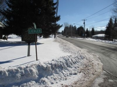
On Boston State Road (County Route 227) at Liebler Road, on the left when traveling south on Boston State Road.
2 New York, Erie County, Brant — Town of Brant Memorial Park
On Brant Farnham Road (New York State Route 249) at Brant Angola Road (County Route 323), on the right when traveling west on Brant Farnham Road.
3 New York, Erie County, Buffalo, Black Rock — Unity Island
On Niagara Street (New York State Route 266) 0.2 miles north of Tonawanda Street (New York State Route 265), on the left when traveling north.
4 New York, Erie County, Buffalo, Cazenovia Park — Final resting place of The Senecas
On Fields Avenue.
5 New York, Erie County, Buffalo, Cazenovia Park — Rebecca Gilbert and Elizabeth Peart
On Buffum Street.
6 New York, Erie County, Buffalo, Delaware Park — Red Jacket
Near Main Street (New York State Route 5) near Delaware Avenue.
7 New York, Erie County, Buffalo, Seneca Indian Park — db m137871 — Seneca Indian Park
On 150 Buffum Street.
8 New York, Erie County, Buffalo, Waterfront — Historic Lake Erie
On Erie Street, 0.5 miles west of Marine Drive, on the right when traveling south.
9 New York, Erie County, Buffalo, Waterfront — Keepers of the Western Door
Near Erie Street, 0.5 miles north of Marine Drive.
10 New York, Erie County, Cheektowaga — Buffalo Creek Indian Reservation North Boundary
On William Street at Starlite Avenue, on the right on William Street.
11 New York, Erie County, Elma — Big Flats
On Bowen Road, 0.1 miles north of Cemetery Road, on the right when traveling north.
12 New York, Erie County, Tonawanda — City of TonawandaA Community Built Around Lumber
On East Main Street at Longs Avenue, on the right when traveling west on East Main Street.
13 New York, Erie County, West Seneca — Jack Berry's Town
On Clinton Street (New York State Route 354) 0.1 miles east of Union Road (New York State Route 277), on the right when traveling east.
14 New York, Erie County, West Seneca — 119 — Kau-Qua-Tau — Legends & Lore —
On Main Street, 0.2 miles east of Mill Road when traveling south.
15 New York, Erie County, West Seneca — Onondaga Village
On Seneca Street at Ridge Road, on the right when traveling west on Seneca Street.
Paid Advertisement
16 New York, Erie County, West Seneca — Red Jacket"Sa-go-ye-wat-ha"
On Seneca Street, 1 mile east of Mill Road, on the right when traveling west.
 
 
CeraNet Cloud Computing sponsors the Historical Marker Database.
This website earns income from purchases you make after using our links to Amazon.com. We appreciate your support.
Paid Advertisement
May. 19, 2024