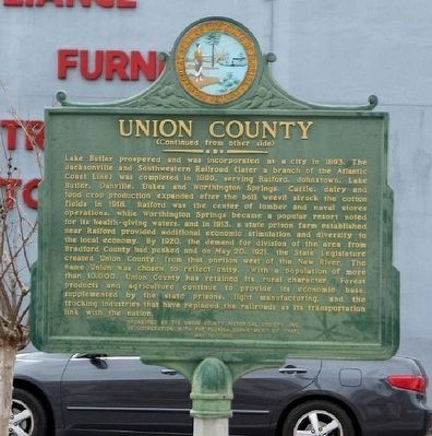
On West Main Street, on the right when traveling west.
Union County, established on October 1, 1921, is the smallest of Florida's 67 counties. Its 245 square miles are bounded by Baker County on the north and by the natural boundaries of Olustee Creek, the Santa Fe River and the New River. Once . . . — — Map (db m64266) HM
On County Road 238, on the left when traveling west.
Providence is believed to be the second oldest Florida settlement next to St. Augustine. The Lonnie Summers Family found this statement written on the wall of the Old Odem House they purchased in 1936: "St. Augustine was founded in 1565. Shortly . . . — — Map (db m55808) HM
On Southwest 6th Street (Florida Route 121) near Southwest 8th Avenue.
In 1957, during the period of Jim Crow segregation. the Union County
School Board decided to build a new school, consolidating all the surrounding
Black schools of the county. Beforehand. Black children were bused to
A.L. Mebane School and . . . — — Map (db m266169) HM
On County Road 231A near NW 150th Circle, on the left when traveling west.
Continuous religious services have been held on this site since 1844. The first church, of hand hewn logs was erected, and the following were elected elders at the time of constitution, February 20, 1847: Cornealus Buey and Sham Peacock. The first . . . — — Map (db m65690) HM
On U.S. 169 at East 2nd Street, on the left when traveling north on U.S. 169.
The last of Missouri's 114 counties to be formed, Worth was organized in Feb., 1861, 6 months and 39 years after Missouri was admitted into the Union, Aug., 1821, with 25 counties. Encompassing 267 sq. miles of glacial prairie, it is the State's . . . — — Map (db m179674) HM
Thin black lines indicate changes in relevance. Between each pair of lines entries are ordered geographically but all have the same relevance.
* Inflectional forms of words are their plurals, singulars, and possessives as well as gramatical tenses and similar variations.