Leesburg in Loudoun County, Virginia — The American South (Mid-Atlantic)
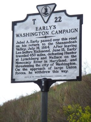
Early’s Washington Campaign
Erected 1982 by the Virginia Historic Landmarks Commission. (Marker Number T-22.)
Topics and series. This historical marker is listed in this topic list: War, US Civil. In addition, it is included in the Virginia Department of Historic Resources (DHR) series list. A significant historical date for this entry is June 13, 1787.
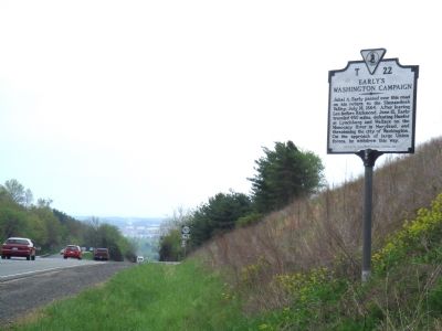
Location. 39° 7.967′ N, 77° 35.45′ W. Marker is in Leesburg, Virginia, in Loudoun County. Marker is at the intersection of Harry Byrd Highway (Virginia Route 7) and West Market Street (Business Virginia Route 7), on the left when traveling west on Harry Byrd Highway. Touch for map. Marker is in this post office area: Leesburg VA 20176, United States of America. Touch for directions.
Other nearby markers. At least 5 other markers are within 2 miles of this marker, measured as the crow flies. Rust Manor House (approx. 0.9 miles away); Clarkes Gap (approx. 1.1 miles away); A Serious Business (approx. 1.2 miles away); The Garden (approx. 1.2 miles away); The Farmhand House (approx. 1.2 miles away). Touch for a list and map of all markers in Leesburg.
More about this marker. A marker with the same number, title, and text stood two miles west of Leesburg, near here, on the old alignment of Route 7, in 1932. It may have been erected in the 1920s.
Also see . . .
1. Jubal Anderson Early (1816–1894). (Submitted on May 6, 2007, by J. J. Prats of Powell, Ohio.)
2. Autobiographical Sketch and Narrative of the War Between States. by Lieutenant General Jubal Anderson Early C.S.A. (Submitted on May 6, 2007.)
Additional keywords. Confederate General Jubal A. Early
Credits. This page was last revised on July 14, 2019. It was originally submitted on May 6, 2007, by J. J. Prats of Powell, Ohio. This page has been viewed 1,749 times since then and 35 times this year. Photos: 1, 2. submitted on May 6, 2007, by J. J. Prats of Powell, Ohio.

