Zona Centro in San Francisco de Campeche in Campeche, Mexico — The Southeast (Yucatan Peninsula)
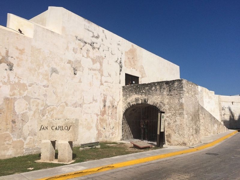
The Bastion of San Carlos
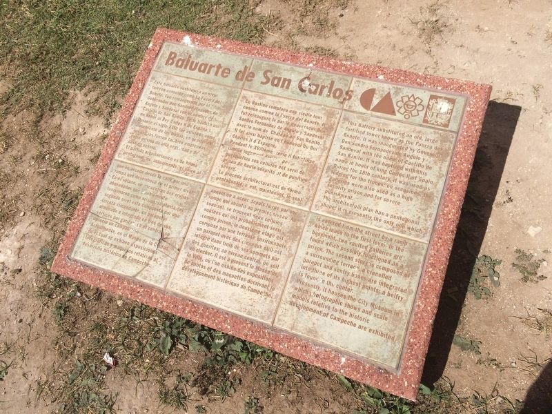
Baluarte de San Carlos
Este baluarte sustituyó a un viejo torreón conocido como La Fuerza del Bonete. Fue reinaugurado por el Gobernador don Sandro Fernández de Angulo y Sandoval con el nombre de Castillo de San Benito. Se le bautizó asi en honor al Rey Carlos II de España. Durante el siglo XVIII fue utilizado como alojamiento de las tropas; en ocasiones sus crujías fueron también empleadas como prisión de alta seguridad y de castigo severo.
El partido arquitectónico es de forma pentagonal: es, actualmente el único al que se accede desde la calle por una rampa que desemboca en el primer nivel. En el sotano, se encuentran dos crujías abovedadas que posiblemente funcionaron como prisión; la planta del segundo nivel esta compuesta por una terraza circundante, un parapeto almenado e integrado en tres de sus vértices por garitas; en el central se aprecia un campanario.
Actualmente, es el Museo de la Ciudad, en el cual se exhiben exposiciones fotográficas y maquetas relativas al desarrollo histórico de Campeche.
French:
Ce Bastion remplaca une vieille tour connue comme la Fuerza del Bonete. It fut reinauguré le par le gouverneur Don Sandro Fernández de Angulo y Sandoval avec le nom de Château de San Benito. Il fut ainsi baptisé en l’honneur du Roi Charles II d’Espagne.
Pendant le XVIIIème siecle il fut utilice comme logement des troupes, quelquefois ses cellules ont servi de prison de haute securite et de punition sevère.
Le procédé architectural est de forme pentagonale; c’est, maintenant, le seul auquel on a accès depues la rue par une rampe qui aboutit au premier niveau. Au sous-sol, se trouvent deux cellules voûtées qui ont probablemente sesvi comme prison; le deuxieme étage este composé par une terrasse environnante, un parapet avec des creneaux et il este intégré dans trois de ses sommets par des guérites; au niveau central, on voit un clocher. Il est à present le Musée de la Ville, où l’on exhibe des expositions de photos et des maquettes décrivant le développement historique de Campeche.
English:
This Battery substituted an old, large fortified tower known as the Fuerza del Bonete. It was inaugurated by Governor Don Sandro Fernández de Angulo y Sandoval with the name of Castillo de San Benito. It was baptized with this name in honor of king Carlos II of Spain. During the 18th century, it was used as lodging for troops; on occasions, the galleries were also used as a high security prison and for severe punishment.
The architectural plan has a pentagonal shape; it is presently the only one which is entered from the Street by a ramp which leads to the first level. In the basement, two vaulted galleries are found which possibly

Photographed By J. Makali Bruton, January 21, 2017
2. An additional nearby Bastion of San Carlos Marker, in Spanish.
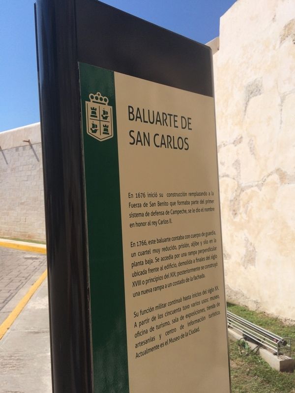
Baluarte de San Carlos
En 1676 inició su construcción remplazando a la Fuerza de San Benito que formaba parte del primer sistema de defensa de Campeche, se le dio el nombre en honor al rey Carlos II.
En 1766, este baluarte contaba con cuerpo de guardia, un cuartel muy reducido, prisión, aljibe y silo en la planta baja. Se accedía por una rampa perpendicular ubicada frente al edificio, demolida a finales del siglo XVIII o principios del XIX; posteriormente se construyó una nueva rampa a un costado de la fachada.
Su función militar continuó hasta inicios del siglo XX. A partir de los cincuenta tuvo varios usos: museo, oficina de turismo, sala de exposiciones, tienda de artesanías y centro de información turística. Actualmente es el Museo de la Ciudad.
Presently, it houses the City Museum in which photographic shows and scale models relative to the historic development of Campeche are exhibited.
Erected by Consejo Nacional para la Cultura y las Artes de México (CONACULTA)-INAH.
Topics. This historical marker is listed in these topic lists: Colonial Era • Forts and Castles • Man-Made Features.
Location. 19° 50.668′ N, 90° 32.429′ W. Marker is in San Francisco de Campeche, Campeche. It is in Zona Centro. Marker is on Calle 8 just west of Calle 63, on the left when traveling east. Touch for map. Marker is at or near this postal address: Calle 8 331, San Francisco de Campeche CAMP 24000, Mexico. Touch for directions.
Other nearby markers. At least 8 other markers are within walking distance of this marker. Governor's Palace (about 120 meters away, measured in a direct line); “Tukulná” Handicrafts House (about 210 meters away); Gate to the Sea (approx. 0.3 kilometers away); Bastion of Our Lady of Solitude (approx. 0.3 kilometers away); The Birthplace of Justo Sierra Méndez (approx. 0.4 kilometers away); "The Palace" Cultural Center

Photographed By J. Makali Bruton, January 21, 2017
3. An additonal nearby Bastion of San Carlos Marker
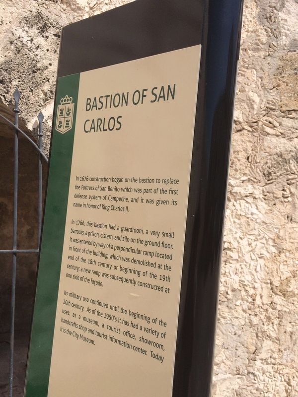
Bastion of San Carlos
In 1676 construction began on the bastion to replace the Fortress of San Benito which was part of the first defense system of Campeche, and it was given its name in honor of King Charles II.
In 1766, this bastion had a guardroom, a very small barracks, a prison, cistern, and silo on the ground floor. It was entered by way of a perpendicular ramp located in front of the building, which was demolished at the end of the 18th century or beginning of the 19th century; a new ramp was subsequently constructed at one side of the façade.
Its military use continued until the beginning of the 20th century. As of the 1950’s it has had a variety of uses: as a museum, a tourist office, showroom, handcrafts shop and tourist information center. Today it is the City Museum.
Credits. This page was last revised on April 29, 2017. It was originally submitted on April 29, 2017, by J. Makali Bruton of Accra, Ghana. This page has been viewed 188 times since then and 13 times this year. Photos: 1, 2, 3, 4. submitted on April 29, 2017, by J. Makali Bruton of Accra, Ghana.

