Near Spotsylvania Courthouse in Spotsylvania County, Virginia — The American South (Mid-Atlantic)
Landram Farm
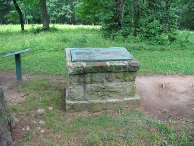
MOLLUS Monument
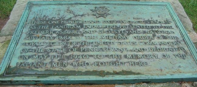
These one hundred and sixty-two acres known as the Landram Farm, were presented to the Fredericksburg and Spotsylvania National Military Park by the Military Order of the Loyal Legion of the United States Commandery of the State of Pennsylvania and dedicated on May 11th, 1940 to the memory of the valiant men who fought here.
Erected 1940 by Military Order of the Loyal Legion of the United States.
Topics. This historical marker is listed in this topic list: War, US Civil. A significant historical month for this entry is May 1864.
Location. 38° 13.685′ N, 77° 35.609′ W. Marker is near Spotsylvania Courthouse, Virginia, in Spotsylvania County. Marker can be reached from Grant Drive, on the left when traveling east. Located on the Bloody Angle trail at tour stop three (Bloody Angle) on the driving tour of Spotsylvania Battlefield unit of the Fredericksburg and Spotsylvania National Military Park. Touch for map. Marker is in this post office area: Spotsylvania VA 22553, United States of America. Touch for directions.
Other nearby markers. At least 8 other markers are within walking distance of this marker. Landram House (here, next to this marker); a different marker also named The Landram House (about 500 feet away, measured in a direct line); Farm to Killing Field (about 600 feet away); Vista Clearing at Spotsylvania (approx. 0.3 miles away); Spotsylvania Campaign (approx. 0.3 miles away); a different marker also named Spotsylvania Campaign (approx. 0.3 miles away); Dawn Assault (approx. 0.4 miles away); Fatal Mistake at the East Angle (approx. 0.4 miles away). Touch for a list and map of all markers in Spotsylvania Courthouse.
Also see . . . Bloody Angle. National Park Service website entry (Submitted on August 16, 2008, by Craig Swain of Leesburg, Virginia.)
Credits. This page was last revised on December 7, 2022. It was originally submitted on August 16, 2008, by Craig Swain of Leesburg, Virginia. This page has been viewed 1,227 times since then and 24 times this year. Photos: 1, 2, 3. submitted on August 16, 2008, by Craig Swain of Leesburg, Virginia.


