Early Settlement
A Diverse Background
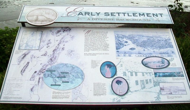
With its sheltered harbour and abundant habitat for a natural food supply, the Yarmouth area was frequented by the native Mi'kmaq before the arrival of European visitors. The area was visited in 1604 by the French explorer Samuel D. Champlain who is credited with naming Cape Forchu. Acadian settlement developed in the 17th century and continues to flourish in Pubnico, Wedgeport and other nearby communities. Settlers from New England began settlements in the 1760s encouraged by offers of land grants. The struggling early settlement was boosted by an influx of Loyalists, including Black Loyalists, from New England by way of Shelburne in 1785.
Early settlers depended upon the fishery for their livelihood.
[Illustration captions, from left to right, read]
• Yarmouth, 1829, looking up Church Hill. Pen and ink sketch by Miss Sarah B. Farish (1789-1876)
• Yarmouth from a map published by A. F. Church c. 1870. The directory indicates the variety of businesses operating at that time.
• Yarmouth harbour and vicinity, from The Atlantic Neptune by J. F. W. Desbarres, Esq. Published according to Act of Parliament, Dec. 1st, 1780 Plate 9
The labels show traditional Mi'kmaq place names [Molegucoke, Te-ceboke, Menegook, Walnaic, Keespougiac] in the vicinity of Yarmouth as recorded by Rev. J. R. Campbell,
• Charlotte Letitia Fletcher, 1800-1843,
Mary Eleanor Fletcher, 1799-1855,
portraits by Joseph Brown Comingo in 1816.
Comingo was an itinerant artist who travelled through Yarmouth County in 1816-17. He was born in Lunenburg, Nova Scotia in 1784.
• Richan's Hotel. By the year 1810 in Yarmouth, "The chief hotel was Richan's, where special sessions from time to time were held. The 'Long Room' in this house was thought wonderful, at the time, for its size. On the north side of the house stood a great willow tree, where from time to time such poor wights as were guilty of petty larceny or the like, were tied up and received 'thirty-nine lashes on the back, well laid on.'" From Rev. J. R. Campbell A History of the County of Yarmouth, Nova Scotia (J. and A. McMillan, Saint John, NB, 1876) Page 126
• Yarmouth 1878
• Yarmouth, 1829, from Patten Road. Sketch by Miss Sarah B. Farish (1789-1876)
• Yarmouth, 1829, looking north from Cumberland Street. Water colour painting by Miss Sarah B. Farish (1789-1876)
• Yarmouth looking west from White Rocks, 1861. Cliff Street is on the right side. From a pencil sketch by James C. Moody.
Photos:Yarmouth County Museum
Learn more about Yarmouth's heritage at the Yarmouth County
Erected 2003 by Yarmouth Waterfront Development Corporation and Others.
Topics and series. This historical marker is listed in these topic lists: Colonial Era • Native Americans • Settlements & Settlers. In addition, it is included in the Acadian History series list. A significant historical year for this entry is 1604.
Location. 43° 50.699′ N, 66° 7.116′ W. Marker is in Yarmouth, Nova Scotia, in Yarmouth County. Marker is on Water Street, on the right when traveling south. Marker is about about 70 meters NNW of Tim Hortons/Wendy's, along the waterfront. Touch for map. Marker is in this post office area: Yarmouth NS B5A 1H8, Canada. Touch for directions.
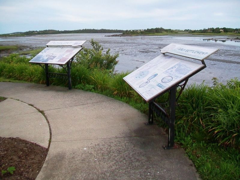
Other nearby markers. At least 8 other markers are within walking distance of this marker. Political Life (here, next to this marker); Milton Clock (a few steps from this marker); Shipbuilding (within shouting distance of this marker); The Fishery (within shouting distance of this marker); Rum Running (within shouting distance of this marker); Land Transportation (about 120 meters away, measured in a direct line); Manufacturing (about 120 meters away); Coronation Park (approx. half a kilometer away). Touch for a list and map of all markers in Yarmouth.
Also see . . .
1. A Brief Town of Yarmouth History. (Submitted on July 26, 2017, by William Fischer, Jr. of Scranton, Pennsylvania.)
2. Yarmouth Heritage. (Submitted on July 26, 2017, by William Fischer, Jr. of Scranton, Pennsylvania.)
Credits. This page was last revised on July 26, 2020. It was originally submitted on July 26, 2017, by William Fischer, Jr. of Scranton, Pennsylvania. This page has been viewed 242 times since then and 11 times this year. Photos: 1, 2. submitted on July 26, 2017, by William Fischer, Jr. of Scranton, Pennsylvania.

