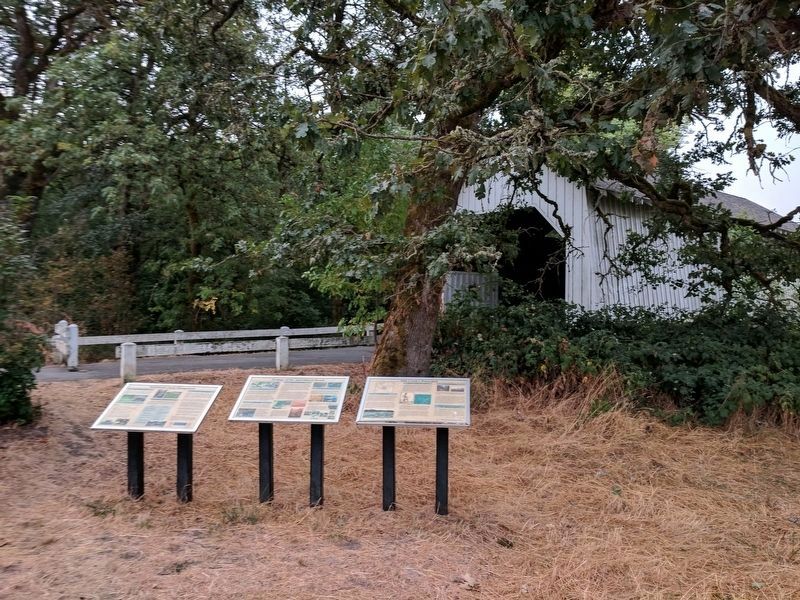
Corvallis in Benton County, Oregon — The American West (Northwest)
Ecology of the Agricultural Reach
The Reach
The Agricultural Reach of Oak Creek drains the croplands and research farm facilities of OSU. The Department of Animal Science manages these agricultural lands. Pastures are used for seasonal grazing and production of hay and other forage crops. Irrigation water is pumped from Oak Creek.
Scientists and managers in the Departments of Animal Science, Fisheries & Wildlife, Forest Engineering, and Bioresource Engineering are establishing conservation practices in the Agricultural Reach, such as riparian fencing and plantings, that will improve stream, wetland and riparian conditions while assuring agricultural production objectives are met.
Education
The Agricultural Reach offers students an outdoor laboratory for academic studies. OSU students from Animal Sciences, Fisheries & Wildlife, Soil Science, Zoology, and Forestry use Oak Creek to study the physical, biological and social processes that occur in watersheds.
The bike path that bisects the agricultural lands of OSU provides a close-up view of dairy operations and research applications that focus on conservation and restoration of important watershed processes.
Current Research
Restoring Wetlands: Upstream of the covered bridge, between the bike path and Oak Creek, you will find the results of a study to design inexpensive methods to restore wetlands in agricultural landscapes. With only minor excavation of the pasture to better retain winter rainwater, a wetland was reborn. Native plants from the site's seed bank have sprouted and replaced pasture grasses. Ducks, geese, frogs, great blue herons, and red-winged blackbirds are common users of the restored wetland.
Subsurface drainage: In the spring of 2000, high levels of E. coli bacteria were detected in Oak Creek. To investigate the source of this contamination, one graduate student looked to the field where liquid manure is used for irrigation. The field southeast of the dairy had subsurface drainage installed decades ago. These “drain tile" networks are designed to remove water from the soil profile allowing land managers earlier access to fields. Since these systems accelerate transport of water to Oak Creek, knowing their location is important.
Using a cesium magnetometer, researchers were able to map the location of drain tile networks. Tracers were then applied to the soil surface and samples taken from outflows. The results showed that both natural drainage features (cracks, worm holes, root channels, mammal burrows) and drain tiles functioned together to transport surface water.
Biological Diversity
The Agricultural Reach of Oak Creek is home to many species of fish including Chinook salmon, cutthroat trout, redside shiners (shown below), Pacific lamprey, western brook lamprey, speckled dace, threespined stickelback, and reticulate and torrent sculpins. Pacific tree frogs, garter snakes, and salamanders also inhabit the Reach and its wetlands.
Mammals of the Reach include: blacktail deer, raccoons, oppossums, nutria, squirrels, foxes, coyotes, deer mice, voles, and of course, beavers.
Birds that can be found in the Reach include: mallard and wood ducks, herons, red-winged blackbirds, red-tailed hawks, kestrels, flickers, woodpeckers, great horned owls, and seasonal migrants such as yellow Warblers.
Erected by Oregon State University.
Topics. This historical marker is listed in these topic lists: Agriculture • Animals • Education • Environment.
Location. 44° 34.005′ N, 123° 18.042′ W. Marker is in Corvallis, Oregon, in Benton County. Marker is on SW Campus Way, half a mile west of SW 35th Street, on the left when traveling west. Located at the Irish Bend Covered Bridge and Midge Cramer Path. Touch for map. Marker is in this post office area: Corvallis OR 97330, United States of America. Touch for directions.
Other nearby markers. At least 8 other markers are within 2 miles of this marker , measured as the crow flies. Sustainable Farm Management (here, next to this marker); Oak Creek’s Watershed (here, next to this marker); Peavy Hall War Memorial (approx. ¾ mile away); Alice E. Biddle (approx. 1.1 miles away); Oregon State University (approx. 1.3 miles away); Kearney Hall (approx. 1.4 miles away); Kings Valley Millstone (approx. 1½ miles away); Avery Park Applegate Trail Kiosk (approx. 1.6 miles away). Touch for a list and map of all markers in Corvallis.
Also see . . . Oregon State University. (Submitted on September 17, 2017.)
Credits. This page was last revised on September 17, 2017. It was originally submitted on September 17, 2017, by Bernard Fisher of Richmond, Virginia. This page has been viewed 179 times since then and 8 times this year. Photos: 1, 2. submitted on September 17, 2017, by Bernard Fisher of Richmond, Virginia.

