Yorktown in York County, Virginia — The American South (Mid-Atlantic)
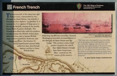
French Trench
The 1781 Siege of Yorktown
— Colonial National Historical Park —
“The ships were enwrapped in a torrent of fire, which spreading with vivid brightness among the combustible rigging, and running with amazing rapidity to the tops of the several masts, while all around was thunder and lightning for our numerous cannon and mortars, and in the darkness of night, presented one of the most sublime and magnificent spectacles which can be imagined.”
Dr. James Thacher, Surgeon, Continental Army
Erected by Colonial National Historical Park, National Park Service.
Topics and series. This historical marker is listed in these topic lists: Notable Events • Notable Places • War, US Revolutionary. In addition, it is included in the Former U.S. Presidents: #01 George Washington series list.
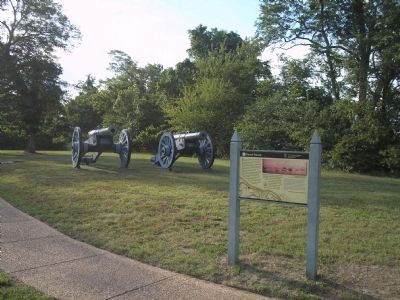
Location. 37° 14.438′ N, 76° 31.288′ W. Marker is in Yorktown, Virginia, in York County. Marker is on Fusiliers Redoubt ramp, on the left when traveling east. Marker is located across the road from the Yorktown Victory Center. Touch for map. Marker is in this post office area: Yorktown VA 23690, United States of America. Touch for directions.
Other nearby markers. At least 8 other markers are within walking distance of this marker. The Washington – Rochambeau Route to Victory (within shouting distance of this marker); a different marker also named French Trench (about 300 feet away, measured in a direct line); Fusiliers Redoubt (about 400 feet away); Washington-Rochambeau Route (about 600 feet away); Naval Weapons Station (approx. 0.6 miles away); The Yorktown Windmill (approx. 0.6 miles away); John Smith Explores the Chesapeake (approx. 0.6 miles away); Join the Adventure (approx. 0.6 miles away). Touch for a list and map of all markers in Yorktown.
More about this marker. The bottom of the marker features a map of the French batteries in relation to the vessels that they set afire. The location of the marker is also indicated. The upper right of the marker contains a reproduction of a “1781 French map illustration depicting the destruction of the HMS Charon. Lithograph courtesy of the Edward E. Ayer collection, the Newberry Library, Chicago.”
Also see . . .
1. Yorktown Battlefield. National Park Service. (Submitted on September 1, 2008, by Bill Coughlin of Woodland Park, New Jersey.)
2. The Battle of Yorktown. The Patriot Resource website. (Submitted on September 1, 2008, by Bill Coughlin of Woodland Park, New Jersey.)
3. The Battle of Yorktown 1781. A British perspective of the Battle of Yorktown from BritishBattles.com. (Submitted on September 1, 2008, by Bill Coughlin of Woodland Park, New Jersey.)

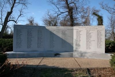
Photographed By Carl Clifford, March 2, 2009
4. Souvenir Français memorial
South face of the Souvenir Français memorial.
Inscription along top: Ce monument est dédié aux soldats et marins du corps expéditionnaire français morts pour l'independance des Etats-Unis pendant la campagne de Yorktown.
This monument is dedicated to the soldiers and sailors of the French expeditionary corps who died for the independance of the United States during the Yorktown campaign.
Credits. This page was last revised on June 16, 2016. It was originally submitted on September 1, 2008, by Bill Coughlin of Woodland Park, New Jersey. This page has been viewed 1,452 times since then and 32 times this year. Photos: 1. submitted on March 20, 2009, by Carl Clifford of Arlington, Virginia. 2, 3. submitted on September 1, 2008, by Bill Coughlin of Woodland Park, New Jersey. 4. submitted on March 20, 2009, by Carl Clifford of Arlington, Virginia.


