Tryon in Polk County, North Carolina — The American South (South Atlantic)
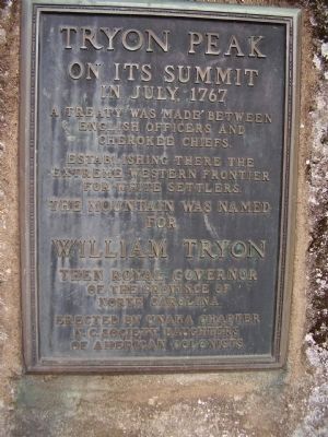
Tryon Peak
Establishing there the extreme western frontier for White settlers.
The Mountain was named for
William Tryon
Erected by Unaka Chapter, N.C. Society Daughters of American Colonists.
Topics and series. This historical marker is listed in these topic lists: Native Americans • Notable Events. In addition, it is included in the Daughters of the American Colonists series list. A significant historical month for this entry is July 1767.
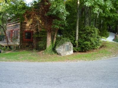
Location. 35° 13.343′ N, 82° 15.119′ W. Marker is in Tryon, North Carolina, in Polk County. Marker is at the intersection of Harmom Field Road and N.Trade Street (U.S. 176) on Harmom Field Road. Touch for map. Marker is in this post office area: Tryon NC 28782, United States of America. Touch for directions.
Other nearby markers. At least 8 other markers are within 3 miles of this marker, measured as the crow flies. Harmon Field (about 700 feet away, measured in a direct line); Sidney Lanier (approx. one mile away); a different marker also named Sidney Lanier (approx. one mile away); Tryon Toy House (approx. one mile away); Stoneman's Raid (approx. 1.1 miles away); The Tryon Horse (approx. 1.2 miles away); Tryon Mountain (approx. 1.4 miles away); The Block House (approx. 2.2 miles away). Touch for a list and map of all markers in Tryon.
Credits. This page was last revised on August 23, 2023. It was originally submitted on September 8, 2008, by Stanley and Terrie Howard of Greer, South Carolina. This page has been viewed 1,393 times since then and 68 times this year. Last updated on August 22, 2023, by Carl Gordon Moore Jr. of North East, Maryland. Photos: 1, 2, 3. submitted on September 8, 2008, by Stanley and Terrie Howard of Greer, South Carolina. • Bernard Fisher was the editor who published this page.


