St. Helens in Columbia County, Oregon — The American West (Northwest)
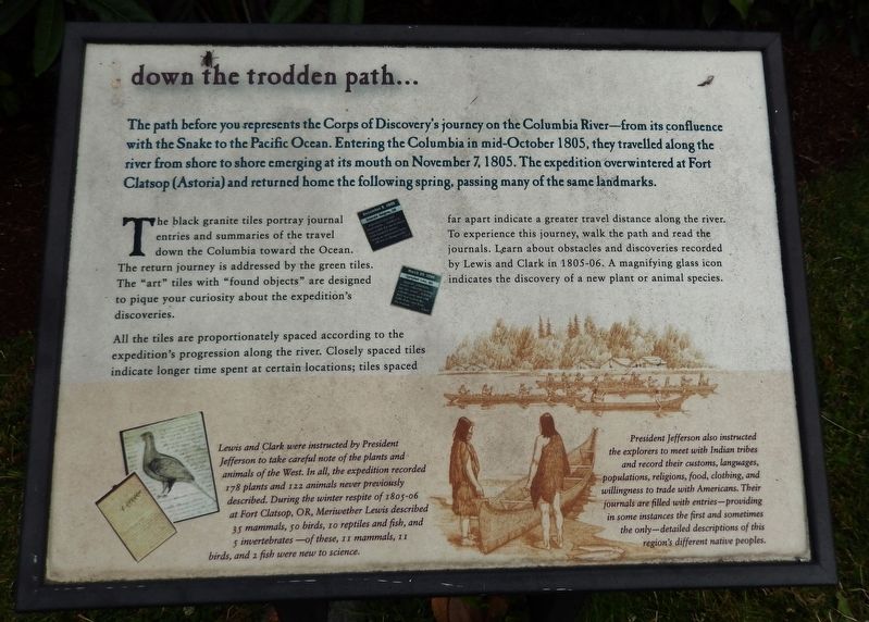
down the trodden path...
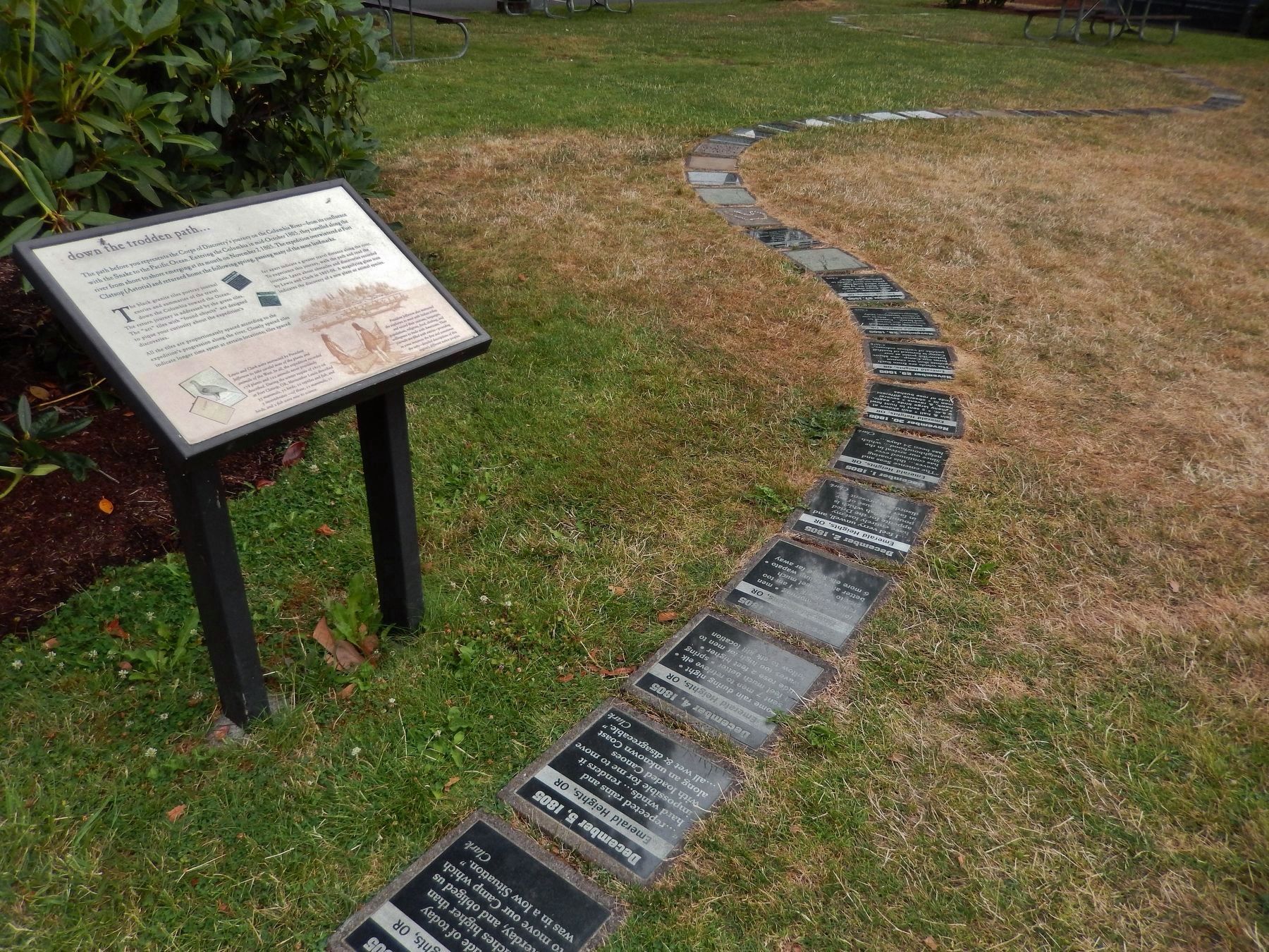
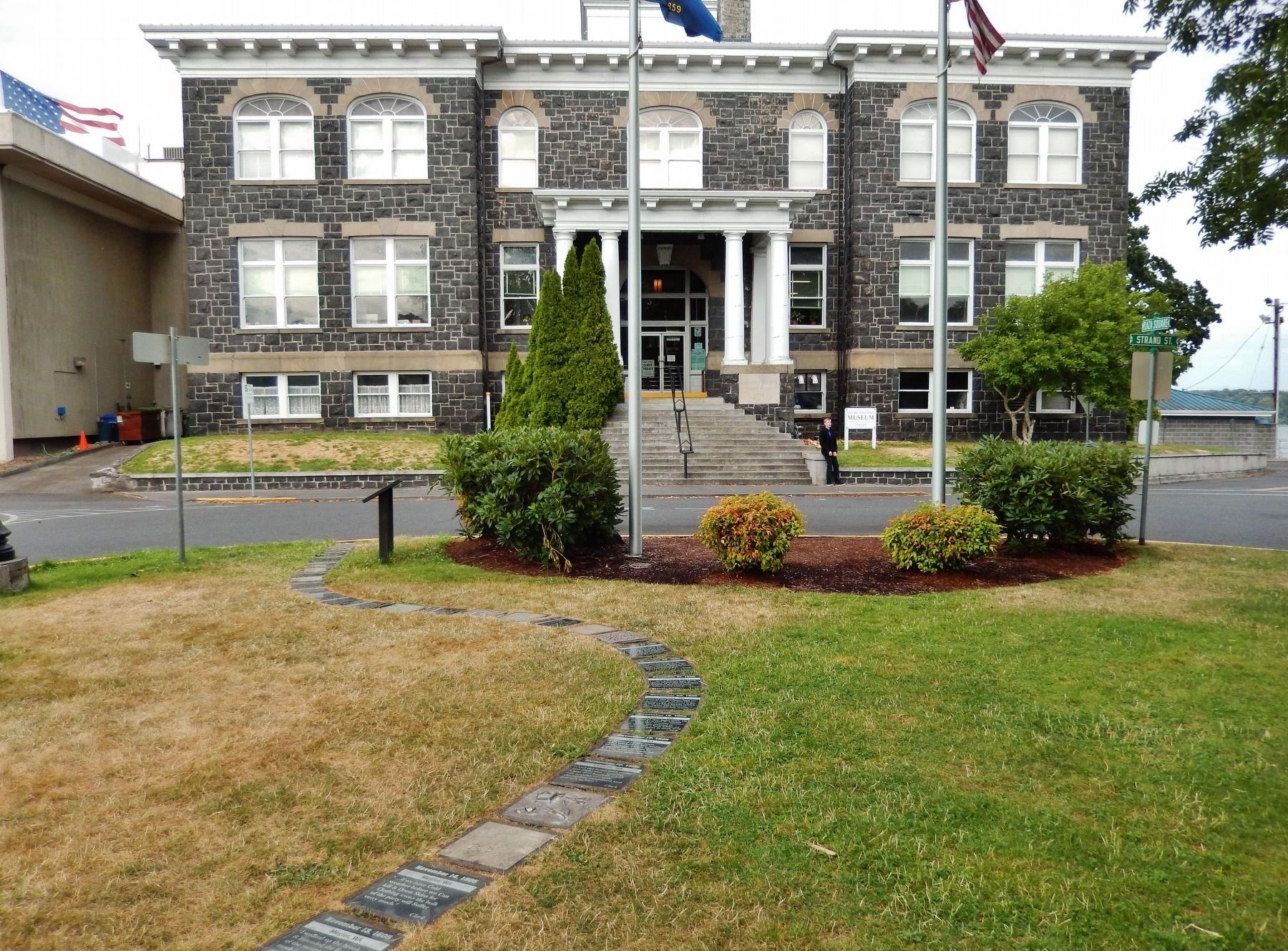
The path before you represents the Corps of Discovery's journey on the Columbia River – from its confluence with the Snake to the Pacific Ocean. Entering the Columbia in mid-October 1805, they travelled along the river from shore to shore emerging at its mouth on November 7, 1805. The expedition overwintered at Fort Clatsop (Astoria) and returned home the following spring, passing many of the same landmarks.
The black granite tiles portray journal entries and summaries of the travel down the Columbia toward the Ocean. The return journey is addressed by the green tiles. The "art" tiles with "found objects" are designed to pique your curiosity about the expedition's discoveries.
All the tiles are proportionately spaced according to the expedition's progression along the river. Closely spaced tiles indicate longer time spent at certain locations; tiles spaced far apart indicate a greater travel distance along the river. To experience this journey, walk the path and read the journals. Learn about obstacles and discoveries recorded by Lewis and Clark in 1805-06. A magnifying glass icon indicates the discovery of a new plant or animal species.
Lewis and Clark were instructed by President Jefferson to take careful note of the plants and animals of the West. In all, the expedition recorded 178 plants and 122 animals never previously described. During the winter respite of 1805-06 at Fort Clatsop, OR, Meriwether Lewis described 35 mammals, 50 birds, 10 reptiles and fish, and 5 invertebrates - of these, 11 mammals, 11 birds, and 2 fish were new to science.
President Jefferson also instructed the explorers to meet with Indian tribes and record their customs, languages, populations, religions, food, clothing, and willingness to trade with Americans. Their journals are filled with entries - providing in some instances the first and sometimes the only - detailed descriptions of this region's different native peoples.
Topics and series. This historical marker is listed in these topic lists: Exploration • Native Americans • Science & Medicine • Settlements & Settlers. In addition, it is included in the Former U.S. Presidents: #03 Thomas Jefferson, and the Lewis & Clark Expedition series lists.
Location. 45° 51.795′ N, 122° 47.838′ W. Marker is in St. Helens, Oregon, in Columbia County. Marker is at the intersection of Yachts Landing and The Strand, on the left when traveling west on Yachts Landing. Marker is located in Plaza Square, west of the old Columbia County Courthouse building. Touch for map. Marker is in this post office area: Saint Helens OR 97051, United States of America. Touch for directions.
Other nearby markers.
At least 8 other markers are within 9 miles of this marker, measured as the crow flies. Lewis & Clark Discovery Trail (a few steps from this marker); Warrior Rock Fog Bell (within shouting distance of this marker); Woodland Community Veterans Memorial (approx. 3.6 miles away in Washington); Early Highway of the West (approx. 7.2 miles away in Washington); Fort Vancouver (approx. 7.2 miles away in Washington); The Finn Hall (approx. 7½ miles away in Washington); Thomas McKay (approx. 8.8 miles away); Lewis and Clark on the Columbia (approx. 8.8 miles away). Touch for a list and map of all markers in St. Helens.
Also see . . .
1. Lewis and Clark encountered many new species of animals and plants. Lewis abd Clark's Expedition website entry:
On Lewis and Clark's expedition, they encountered 120 mammals, reptiles, and fish. Some examples of these animals are Coyotes, Eastern Wood Rats, Grizzly Bears, Prairie Dogs, and Pronghorn Antelopes. On these expeditions, when they found an animal or specimen, they would send them back to the known part of the USA. (Submitted on January 22, 2018, by Cosmos Mariner of Cape Canaveral, Florida.)
2. National Wildlife Refuges Along the Lewis and Clark Trail. U.S. Fish & Wildlife Service website entry (Submitted on March 8, 2022, by Larry Gertner of New York, New York.)
Photographed By Cosmos Mariner, July 10, 2015
4. Path Stones
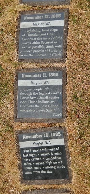
November 12, 1805
Megler, WA
"...Lightining, hard claps of Thunder, and Hail... Canoes at the mercy of the waves, altho Secured as Well as possible, Sunk with emence parcels of Stone to wate them down..." Clark
November 11, 1805
Megler, WA
“...those people left through the highest waves I ever Saw a Small vestles ride. Those Indians are Certainly the best Canoe navigaters I ever Saw." Clark
November 10, 1805
Megler, WA
rained very hard most of last night waves & wind have calmed canoed 10 miles waves high so we found camp storing loads away from the tide
Megler, WA
"...Lightining, hard claps of Thunder, and Hail... Canoes at the mercy of the waves, altho Secured as Well as possible, Sunk with emence parcels of Stone to wate them down..." Clark
November 11, 1805
Megler, WA
“...those people left through the highest waves I ever Saw a Small vestles ride. Those Indians are Certainly the best Canoe navigaters I ever Saw." Clark
November 10, 1805
Megler, WA
rained very hard most of last night waves & wind have calmed canoed 10 miles waves high so we found camp storing loads away from the tide
Photographed By Cosmos Mariner, July 10, 2015
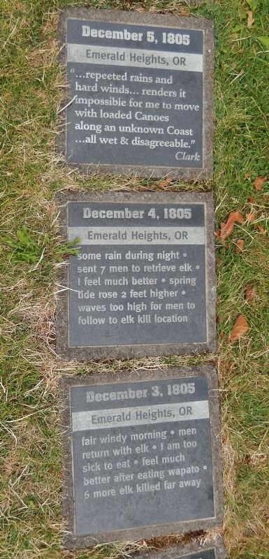
5. Path Stones
December 5, 1805
Emerald Heights, OR
"...repeeted rains and hard winds... renders it impossible for me to move with loaded Canoes along an unknown Coast all wet & disagreeable."
Clark
December 4, 1805
Emerald Heights, OR
some rain during night sent 7 men to retrieve elk feel much better spring tide rose 2 feet higher waves too high for men to follow to elk kill location
December 3, 1805
Emerald Heights, OR
fair windy morning men return with elk I am too sick to eat feel much setter after eating wapato 6 more elk killed far away
Emerald Heights, OR
"...repeeted rains and hard winds... renders it impossible for me to move with loaded Canoes along an unknown Coast all wet & disagreeable."
Clark
December 4, 1805
Emerald Heights, OR
some rain during night sent 7 men to retrieve elk feel much better spring tide rose 2 feet higher waves too high for men to follow to elk kill location
December 3, 1805
Emerald Heights, OR
fair windy morning men return with elk I am too sick to eat feel much setter after eating wapato 6 more elk killed far away
Photographed By Cosmos Mariner, July 10, 2015
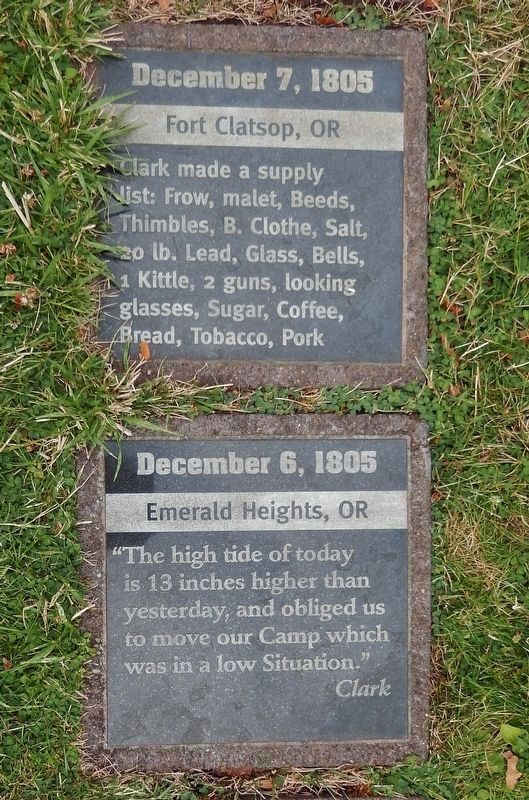
6. Path Stones
December 7, 1805
Fort Clatsop, OR
Clark made a supply list: Frow, malet, Beeds, Thimbles, B. Clothe, Salt, 20 lb. Lead, Glass, Bells, 1 Kittle, 2 guns, looking glasses, Sugar, Coffee, Bread, Tobacco, Pork
December 6, 1805
Emerald Heights, OR
"The high tide of today is 13 inches higher than yesterday, and obliged us to move our Camp which was in a low Situation."
Clark
Credits. This page was last revised on March 9, 2022. It was originally submitted on January 21, 2018, by Cosmos Mariner of Cape Canaveral, Florida. This page has been viewed 271 times since then and 17 times this year. Photos: 1. submitted on January 21, 2018, by Cosmos Mariner of Cape Canaveral, Florida. 2, 3, 4, 5, 6. submitted on January 22, 2018, by Cosmos Mariner of Cape Canaveral, Florida. • Andrew Ruppenstein was the editor who published this page.
