Valle de Bravo, Mexico State, Mexico — The Central Highlands (North America)
Villagrán Street
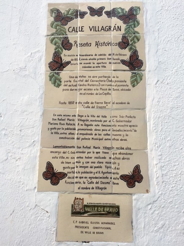
Reseña Histórica
En sesión extraordinaria de cabildo del 14 de febrero de 1852, siendo alcalde primero Don Ramón Uriarte, se arcordó la apertura de nuevas calzadas en esta Villa. Una de estas se abre partiendo de la parte frontal del Cementerio (lado poniente del actual Centro Histórico) con rumbo al poniente para dar mejor acceso a la Plaza de Toros, ubicada en el rumbo de La Capilla.
Hasta 1857 esta calle de tierra llevó el nombre de “Calle del Diezmo”
En este mismo año llega a la Villa del Valle como Sub-Prefecto Don Rafael María Villagrán, nombrado por el C. Gobernador Mariano Riva Palacio. A su llegada este funcionario muestra aprecio y gusto por la población, promoviendo obras para el “embellecimiento” de la Villa, entre ellas el empedrado de las calles nuevas y la construcción del palacio Municipal entre otras obras.
Lamentablemente Don Rafael María Villagrán recibe otro encargo del C. Gobernador por lo que tiene que abandonar esta Villa, no sin antes haber realizado muchas obras de bien común y con una clara vocación y gusto por la imagen del pueblo Típico. A su partida, la población y el H. Ayuntamiento deciden en que en agradecimiento a este funcionario, la “Calle del Diezmo” lleve el nombre de Villagrán
H. Ayuntamiento Constitucional
C.P. Gabriel Olvera Hernandez
Presidente Constitucional
de Valle de Bravo
Historical Summary
In an extraordinary session of the Town Council on February 14, 1852, the first mayor, Ramón Uriarte, celebrated the opening of new roads in this Villa. One of these new roads was opened from the front of the cemetery (the west side of the current Historical Center) towards the west to give better access to the Plaza de Toros (Bullring) while heading to La Capilla (the Chapel).
Until 1857 this unpaved street was named "Street of the Diezmo (the Tithe)"
In this same year, the Sub-Prefect Rafael María Villagrán arrived to this Villa del Valle, named by the Governor Mariano Riva Palacio to this position. Upon his arrival, this official showed great appreciation and pleasure in his assignment, promoting works for the "embellishment" of the Villa, among them the paving of the new streets and the construction of the Municipal Palace, among other works.
Unfortunately, Rafael María Villagrán received another commission from the Governor, so had
to leave this Villa, but not before having done many good works for the image of this “Typical Town”. At his departure, the people and Town Council decided, that as a show of gratitude to this official, the "Calle del Diezmo" would be renamed as “Villagrán Street”
Honorable and Constitutional Town Hall
C.P. Gabriel Olvera Hernández
Constitutional President of Valle de Bravo
Erected by Honorable Ayuntamiento Constitucional de Valle de Bravo.
Topics. This historical marker is listed in these topic lists: Charity & Public Work • Government & Politics • Man-Made Features • Roads & Vehicles. A significant historical date for this entry is February 14, 1852.
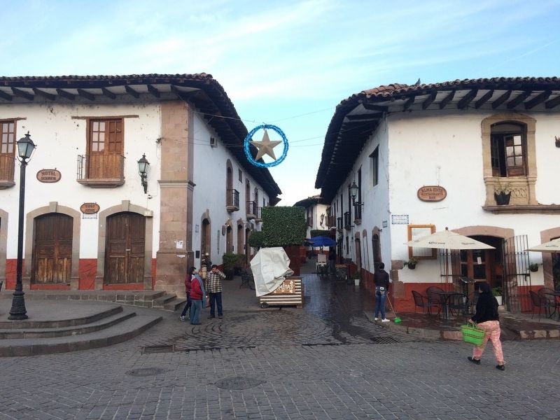
Location. 19° 11.623′ N, 100° 7.92′ W. Marker is in Valle de Bravo, Estado de Mexico (Mexico State). Marker is on Calle Villagrán just west of Calle 5 de Febrero, on the left when traveling west. Calle Villagrán is pedestrian-only in this part near the town center. Touch for map. Marker is in this post office area: Valle de Bravo MEX 51200, Mexico. Touch for directions.
Other nearby markers. At least 8 other markers are within walking distance of this marker. Coliseum Street (within shouting distance of this marker); Nicolás Bravo (within shouting distance of this marker); The Name of Valle de Bravo (about 90 meters away, measured in a direct line); The Mexican Constitution of 1857 (about 90 meters away); Pedro Velázquez H. (about 90 meters away); Joaquín Arcadio Pagaza (about 90 meters away); Valle de Bravo in the Mexican-American War (about 120 meters away); José Castillo y Piña (about 180 meters away). Touch for a list and map of all markers in Valle de Bravo.
Credits. This page was last revised on February 3, 2018. It was originally submitted on February 3, 2018, by J. Makali Bruton of Accra, Ghana. This page has been viewed 133 times since then and 7 times this year. Photos: 1, 2. submitted on February 3, 2018, by J. Makali Bruton of Accra, Ghana.

