Near Bushnell in Sumter County, Florida — The American South (South Atlantic)
Pilaklikaha/Abraham's Town
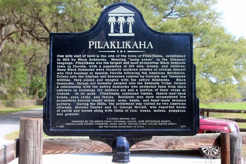
Pilaklikaha
One mile east of here is the site of the town of Pilaklikaha, established in 1813 by Black Seminoles. Meaning "many ponds" in the Mikasuki language, Pilaklikaha was the largest and most prosperous Black Seminole town in Florida, with a population of 100 men, women, and children. Many Black Seminoles were formerly enslaved peoples of African descent who fled bondage to Spanish Florida following the American Revolution. Driven into the Alachua and Suwannee regions by Georgia and Tennessee militias, they joined and mingled with the native Seminoles. Black Seminoles, though not formally adopted into the Seminole Tribe, formed a relationship with the native Seminoles who protected them from slave catchers in exchange for military aid and a portion of their crops as tribute. At its peak, Pilaklikaha contained timber, thatch-and-daub homes, corn cribs, and fences. Residents may have accumulated few possessions beyond simple dishes, arms, beads, and hand-made brushed pottery. During the 1820s, the settlement was visited by two American officials, Horatio Dexter and Lt. George McCall, who reported herds of cattle and horses along with fields of rice, beans, melons, pumpkins, and peanuts.
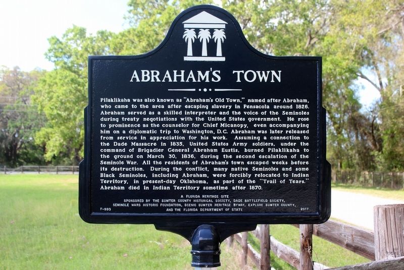
Abraham's Town
Pilaklikaha was also known as "Abraham's Old Town," named after Abraham, who came to the area after escaping slavery in Pensacola around 1826. Abraham served as a skilled interpreter and the voice of the Seminoles during treaty negotiations with the United States government. He rose to prominence as the counselor for Chief Micanopy, even accompanying him on a diplomatic trip to Washington, D.C. Abraham was later released from service in appreciation for his work. Assuming a connection to the Dade Massacre in 1835, United States Army soldiers, under the command of Brigadier General Abraham Eustis, burned Pilaklikaha to the ground on March 30, 1836, during the second escalation of the Seminole War. All the residents of Abraham's town escaped weeks before its destruction. During the conflict, many native Seminoles and some Black Seminoles, including Abraham, were forcibly relocated to Indian Territory, in present-day Oklahoma, as part of the "Trail of Tears." Abraham died in Indian Territory sometime after 1870.
Erected 2017 by The Sumter County Historical Society, Dade Battlefield Society, Seminole Wars Historic Foundation, Scenic Sumter Heritage Byway, Explore Sumter County, and the Florida Department of State. (Marker Number F-993.)
Topics and series. This historical marker is listed in these topic lists: African Americans • Native Americans • Settlements & Settlers • Wars, US Indian. In addition, it is included in the Trail of Tears series list. A significant historical year for this entry is 1813.
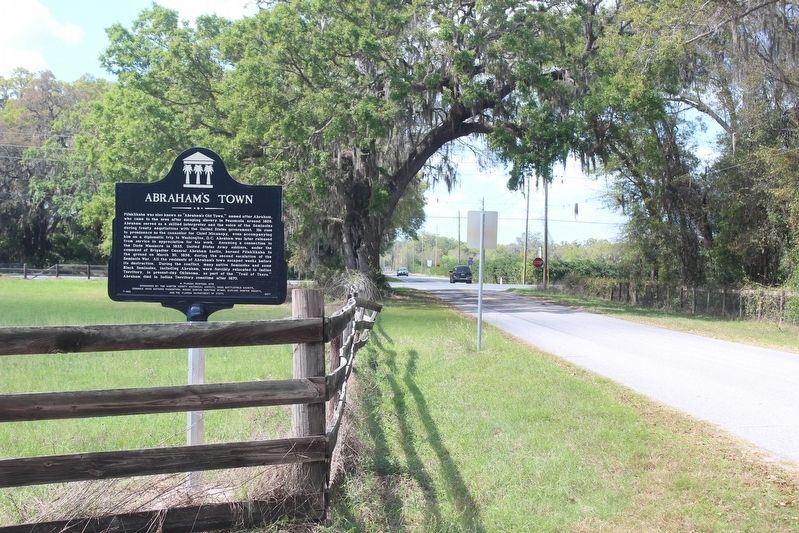
Location. 28° 39.881′ N, 82° 3.226′ W. Marker is near Bushnell, Florida, in Sumter County. Marker is at the intersection of County Road 567 and State Road 471, on the right when traveling east on County Road 567. CR 567 is also known locally as Fortune Teller Rd. Touch for map. Marker is in this post office area: Bushnell FL 33513, United States of America. Touch for directions.
Other nearby markers. At least 8 other markers are within 10 miles of this marker, measured as the crow flies. Sumter County Farmers Market (approx. 3.4 miles away); Bushnell Veterans Memorial (approx. 3.4 miles away); Parson Brown Orange Tree (approx. 3.8 miles away); Ft. Armstrong (approx. 4.4 miles away); On This Spot (approx. 4˝ miles away); Sumterville (approx. 5˝ miles away); Adamsville (approx. 9˝ miles away); Wild Cow Prairie Cemetery (approx. 10 miles away). Touch for a list and map of all markers in Bushnell.
Credits. This page was last revised on July 22, 2018. It was originally submitted on February 27, 2018, by Tim Fillmon of Webster, Florida. This page has been viewed 1,742 times since then and 239 times this year. Photos: 1, 2, 3. submitted on February 27, 2018, by Tim Fillmon of Webster, Florida. • Bernard Fisher was the editor who published this page.


