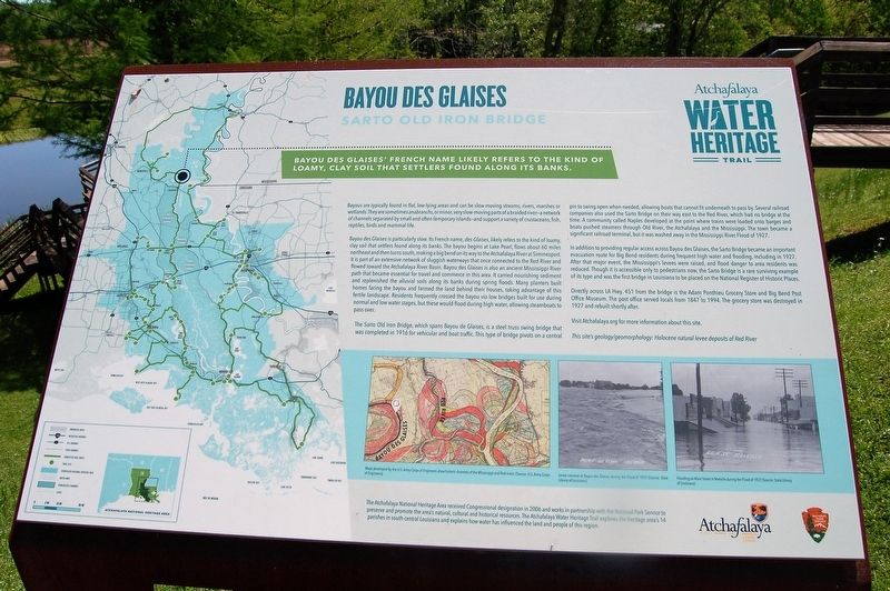
Bayou Des Glaises
SARTO Old Iron Bridge
— Atchafalaya Water Heritage Trail —
Bayou Des Glaises' French name likely refers to the kind of loamy, clay soil that settlers found along its banks.
Bayous are typically found in flat, low-lying areas and can be slow-moving streams, rivers, marshes or wetlands. They are sometimes anabranchs, or minor, very slow-moving parts of a braided river—a network of channels separated by small and often temporary islands—and support a variety of crustaceans, fish, reptiles, birds and mammal life.
Bayou des Glaises is particularly slow. Its French name, des Glaises, likely refers to the kind of loamy, clay soil that settlers found along its banks. The bayou begins at Lake Pearl, flows about 60 miles northeast and then turns south, making a big bend on its way to the Atchafalaya River at Simmesport. It is part of an extensive network of sluggish waterways that once connected to the Red River and flowed toward the Atchafalaya River Basin. Bayou des Glaises is also an ancient Mississippi River path that became essential for travel and commerce in this area. It carried nourishing sediment and replenished the alluvial soils along its banks during spring floods. Many planters built homes facing the bayou and farmed the land behind their houses, taking advantage of this fertile landscape. Residents frequently crossed the bayou via low bridges built for use
during normal and low water stages, but these would flood during high water, allowing steamboats to pass over.The Sarto Old Iron Bridge, which spans Bayou de Glaises, is a steel truss swing bridge that was completed in 1916 for vehicular and boat traffic. This type of bridge pivots on a central pin to swing open when needed, allowing boats that cannot fit underneath to pass by. Several railroad companies also used the Sarto Bridge on their way east to the Red River, which had no bridge at the time. A community called Naples developed at the point where trains were loaded onto barges and boats pushed steamers through Old River, the Atchafalaya and the Mississippi. The town became a significant railroad terminal, but it was washed away in the Mississippi River Flood of 1927.
In addition to providing regular access across Bayou des Glaises, the Sarto Bridge became an important evacuation route for Big Bend residents during frequent high water and flooding, including in 1927. After that major event, the Mississippi’s levees were raised, and flood danger to area residents was reduced. Though it is accessible only to pedestrians now, the Sarto Bridge is a rare surviving example of its type and was the first bridge in Louisiana to be placed on the National Register of Historic Places.
Directly across LA Hwy. 451 from the bridge is the Adam Ponthieu Grocery Store and
Big Bend Post Office Museum. The post office served locals from 1847 to 1994. The grocery store was destroyed in 1927 and rebuilt shortly after.Visit Atchafalaya.org for more information about this site.
This site’s geology/geomorphology: Holocene natural levee deposits of Red River.
Erected by State of Louisiana and National Park Service.
Topics and series. This historical marker is listed in these topic lists: Environment • Waterways & Vessels. In addition, it is included in the Atchafalaya Water Heritage Trail series list.
Location. 31° 4.42′ N, 91° 47.581′ W. Marker is in Big Bend, Louisiana, in Avoyelles Parish. Marker is on State Highway 451 near Iron Bridge Crossing, on the right when traveling north. Touch for map. Marker is at or near this postal address: 8554 LA-451, Moreauville LA 71355, United States of America. Touch for directions.
Other nearby markers. At least 8 other markers are within 7 miles of this marker, measured as the crow flies. A Historic Landmark (here, next to this marker); Big Bend: Development of a Community (here, next to this marker); What is the Sarto Bridge? (a few steps from this marker); Sarto Old Iron Bridge (a few steps from this marker); a different marker also named Sarto Old Iron Bridge (a few steps from this marker); Buddy Guy
Credits. This page was last revised on July 30, 2023. It was originally submitted on April 13, 2018, by Cajun Scrambler of Assumption, Louisiana. This page has been viewed 2,075 times since then and 236 times this year. Photos: 1, 2. submitted on April 13, 2018.

