El Paso in El Paso County, Texas — The American South (West South Central)
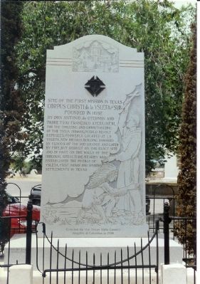
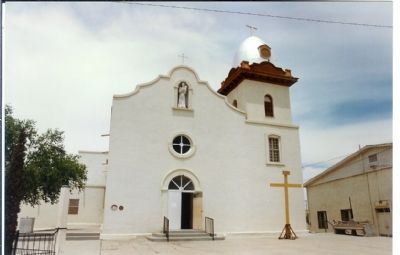
Site Of The First Mission In Texas
Corpus Christi de la Ysleta del Sur
Erected 1936 by Texas State Council , Knights of Columbus.
Topics. This historical marker is listed in these topic lists: Churches & Religion • Colonial Era • Native Americans • Settlements & Settlers. A significant historical year for this entry is 1682.
Location. Marker has been reported missing. It was located near 31° 41.493′ N, 106° 19.656′ W. Marker was in El Paso, Texas, in El Paso County. Marker was at the intersection of South Zaragoza Road and Texas Highway 20 on South Zaragoza Road. Touch for map. Marker was at or near this postal address: 131 South Zaragoza Rd, El Paso TX 79907, United States of America. Touch for directions.
Other nearby markers. At least 8 other markers are within 3 miles of this location, measured as the crow flies. First Mission and Pueblo in Texas (here, next to this marker); Oldest Mission in Texas (here, next to this marker); Alderete-Candelaria House (about 600 feet away, measured in a direct line); Ysleta Plaza (about 600 feet away); San Antonio de Senecú (approx. 1½ miles away); Captain Frank Jones (approx. 1½ miles away); The Camino Real (approx. 2.6 miles away); Socorro (approx. 2.7 miles away). Touch for a list and map of all markers in El Paso.
Additional commentary.
1. A fire
... in 1907 damaged the mission. In 1916, the Rio
Grande was dammed and the area was heavily irrigated.
The resulting rise in the water table brought salt to the surface and the land became suitable for only salt
tolerant crops such as cotton.
— Submitted January 13, 2008, by Mike Stroud of Bluffton, South Carolina.
Credits. This page was last revised on August 27, 2020. It was originally submitted on January 13, 2008, by Mike Stroud of Bluffton, South Carolina. This page has been viewed 4,509 times since then and 28 times this year. Last updated on June 5, 2018, by Brian Anderson of Humble, Texas. Photos: 1, 2. submitted on January 13, 2008, by Mike Stroud of Bluffton, South Carolina. 3. submitted on November 14, 2010, by Bill Kirchner of Tucson, Arizona. 4. submitted on January 13, 2008, by Mike Stroud of Bluffton, South Carolina. • Bill Pfingsten was the editor who published this page.


