Near Hanover in King William County, Virginia — The American South (Mid-Atlantic)
Nelson’s Crossing
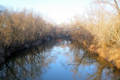
Grant Crosses the Pamunkey
— Lee vs. Grant – The 1864 Campaign —
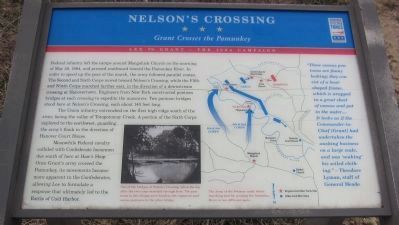
The Union infantry entrenched on the first high ridge south of the river, facing the valley of Totopotomoy Creek. A portion of the Sixth Corps explored to the northwest, guarding the army’s flank in the direction of Hanover Court House.
Meanwhile Federal cavalry collided with Confederate horsemen due south of here at Haw’s Shop. Once Grant’s army crossed the Pamunkey, its movements became more apparent to the Confederates, allowing Lee to formulate a response that ultimately led to the Battle of Cold Harbor.
“These canvas pontoons are funny looking; they consist of a boat-shaped frame, which is wrapped in a great sheet of canvas and put in the water… It looks as if the Commander-in-Chief [Grant] had undertaken the washing business on a large scale, and was ‘soaking’ his soiled clothing.”
- Theodore Lyman, staff of General Meade
Erected by Virginia Civil War Trails.
Topics and series. This historical marker is listed in this topic list: War, US Civil. In addition, it is included in the Virginia Civil War Trails series list. A significant historical date for this entry is May 28, 1864.
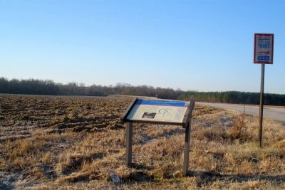
Location. 37° 43.32′ N, 77° 17.176′ W. Marker is near Hanover, Virginia, in King William County. Marker is on Nelson Bridge Road (County Route 615) 0.9 miles north of River Road, on the right when traveling north. Touch for map. Marker is in this post office area: Hanover VA 23069, United States of America. Touch for directions.
Other nearby markers. At least 8 other markers are within 4 miles of this marker, measured as the crow flies. William Latané (approx. 2.1 miles away); Newmarket (approx. 2.2 miles away); Union Army's Crossing of the Pamunkey River (approx. 2.8 miles away); Hanovertown (approx. 2.8 miles away); "Hanover Town" (approx. 2.8 miles away); Studley (approx. 3.2 miles away); Patrick Henry's Birthplace (approx. 3.2 miles away); Salem Church/Haw’s Shop (approx. 3.2 miles away).
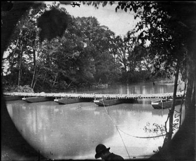
Regarding Nelson’s Crossing. On the lower left is a period photo. The caption reads, One of the bridges at Nelson’s Crossing, taken the day after the two corps marched through here. The
pontoons in this bridge were wooden; the engineers used canvas pontoons in the other bridge.
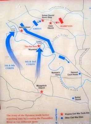
On the right is a map detailing troop movements into Hanover County. The map carries the caption, The Army of the Potomac made better marching time by crossing the Pamunkey River at two different spots.
Credits. This page was last revised on November 9, 2021. It was originally submitted on February 3, 2009, by Bernard Fisher of Richmond, Virginia. This page has been viewed 2,404 times since then and 81 times this year. Last updated on July 26, 2018, by Bradley Owen of Morgantown, West Virginia. Photos: 1. submitted on May 29, 2014, by Craig Swain of Leesburg, Virginia. 2, 3, 4, 5, 6. submitted on February 3, 2009, by Bernard Fisher of Richmond, Virginia. 7. submitted on March 18, 2009, by Bernard Fisher of Richmond, Virginia. • Bill Pfingsten was the editor who published this page.
