Near Shenandoah in Page County, Virginia — The American South (Mid-Atlantic)
The Burning of Red Bridge
The "Last Straw" Between Jackson and Ashby
— 1862 Valley Campaign —
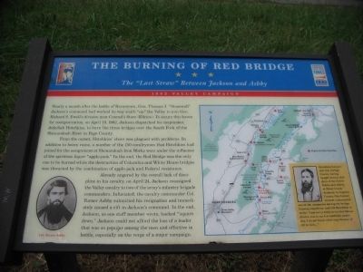
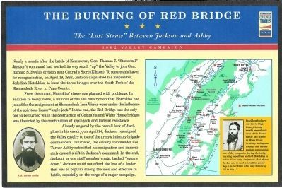
From the onset, Hotchkiss' chore was plagued with problems. In addition to heavy rains, a number of the 150 cavalrymen that Hotchkiss had joined for the assignment at Shenandoah Iron Works were under the influence of the spiritous liquor "apple-jack." In the end, the Red Bridge was the only one to be burned while the destruction of Columbia and White House bridges was thwarted by the combination of apple-jack and Federal resistance.
Already angered by the overall lack of discipline in his cavalry, on April 24, Jackson reassigned the Valley cavalry to two of the army's infantry brigade commanders. Infuriated, the cavalry commander Col. Turner Ashby submitted his resignation and immediately caused a rift in Jackson's command. In the end, Jackson, as one staff member wrote, backed "square down." Jackson could not afford the loss of a leader that was so popular among the men and effective in battle, especially on the verge of a major campaign.
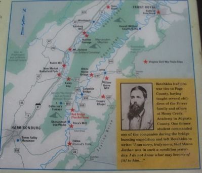
(Sidebar): Hotchkiss had pre-war ties to Page County, having taught several children of the Forrer family and others at Mossy Creek Academy in Augusta County. One former student commanded the companies during the bridge burning expedition and left Hotchkiss to write: "I am sorry, truly sorry, that Macon Jordon was in such a condition yesterday. I do not know what may become of [it] to him..."
Erected by Virginia Civil War Trails.
Topics and series. This historical marker is listed in this topic list: War, US Civil. In addition, it is included in the Virginia Civil War Trails series list. A significant historical month for this entry is April 1890.
Location. 38° 31.627′ N, 78° 35.694′ W. Marker is near Shenandoah, Virginia, in Page County. Marker is at the intersection of Grove Hill River Road (County Route 650) and Crooked Run Road (County Route 603), on the right when traveling west on Grove Hill River Road. Located at the Grove Hill Public Boat Landing on the South Fork of the Shenandoah River. Touch for map. Marker is at or near this postal address: 5700 Grove Hill River Rd, Shenandoah VA 22849, United States of America. Touch for directions.
Other nearby markers. At least 8 other markers are within 4 miles of this marker, measured as the crow flies. Somerville Heights (here, next to this marker); Brick Church School (approx. 1.8 miles away); Shenandoah Iron Works District War Memorial (approx. 2˝ miles away); Execution of Summers and Koontz (approx. 2˝ miles away); Veterans Memorial Fields (approx. 2˝ miles away); Shenandoah World War I & II Memorial (approx. 2.6 miles away); Catherine Furnace (approx. 3 miles away); WWI Cannon 1906 Model (approx. 3.2 miles away). Touch for a list and map of all markers in Shenandoah.
More about this marker. In the lower left of the marker is a portrait of Col. Turner Ashby. On the right is a campaign map of the Shenandoah Valley with Civil War Trails stops indicated by red stars. A portrait of Hotchkiss is inside the sidebar on the lower right.
Regarding The Burning of Red Bridge. This marker is one of several detailing Civil War activities in Page County, Virginia. Please see the Page County Civil War Markers link below.
Also see . . .
1. Page County Civil War Markers. (Submitted on February 25, 2009, by Craig Swain of Leesburg, Virginia.)
2. Avenue of Armies: Civil War Sites and Stories of Luray and Page County, Virginia. (Submitted on March 20, 2009, by Robert H. Moore, II of Winchester, Virginia.)
Credits. This page was last revised on July 8, 2021. It was originally submitted on October 5, 2008, by Craig Swain of Leesburg, Virginia. This page has been viewed 3,259 times since then and 89 times this year. Photos: 1. submitted on October 5, 2008, by Craig Swain of Leesburg, Virginia. 2. submitted on January 13, 2009, by Robert H. Moore, II of Winchester, Virginia. 3, 4. submitted on October 5, 2008, by Craig Swain of Leesburg, Virginia.


