Ogallala in Keith County, Nebraska — The American Midwest (Upper Plains)
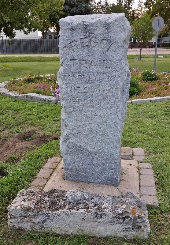
Oregon Trail
Marked by
the State of
Nebraska
1912
Erected 1912 by State of Nebraska, Keith County Historical Society, and the Garden Club.
Topics and series. This historical marker is listed in these topic lists: Notable Places • Parks & Recreational Areas • Roads & Vehicles • Settlements & Settlers. In addition, it is included in the Oregon Trail series list.
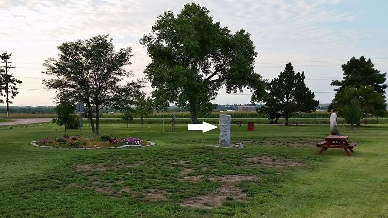
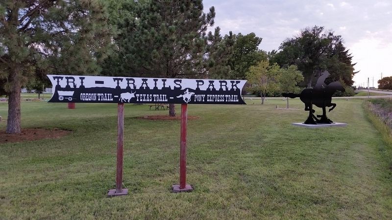
Location. 41° 6.307′ N, 101° 43.21′ W. Marker is in Ogallala, Nebraska, in Keith County. Marker is at the intersection of Lawrence Road and West Road 80, on the left when traveling north on Lawrence Road. Marker is located in Ogallala's Tri-Trails Park, 1 mile south of Ogallala and 1 block west of Nebraska Highway 61. Touch for map. Marker is in this post office area: Ogallala NE 69153, United States of America. Touch for directions.
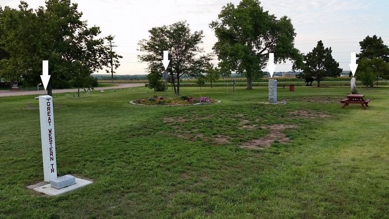
Other nearby markers. At least 8 other markers are within 2 miles of this marker, measured as the crow flies. Sand Hill Station (a few steps from this marker); The Lincoln Highway (approx. 1.3 miles away); Interstate 80 (approx. 1.3 miles away); The Union Pacific (approx. 1.4 miles away); California Hill (approx. 1.4 miles away); Highways 26 and 92 (approx. 1.4 miles away); The Mormon Trail (approx. 1.4 miles away); The Great Platte River Road (approx. 1.4 miles away). Touch for a list and map of all markers in Ogallala.
More about this marker. Tri-Trails Park celebrates the geographic crossing of three major historic trails that passed through Keith County, Nebraska during the 1800s: the Oregon Trail, Pony Express Trail and the Great Western Cattle Trail (a.k.a. the Texas Trail). This Oregon Trail Marker is one of many that are located all along the Oregon Trail in Nebraska. These were made in 1912 by the State of Nebraska. This marker was moved to Tri-Trails Park from a site north of here, by the Old Platte River Bridge (now gone), when Highway 61 was reconstructed. The relocated marker was set in concrete and dedicated at Tri-Trails Park in early April of 1963. The Keith County Historical Society and the Garden Club were in charge of the project.
Related markers. Click here for a list of markers that are related to this marker. Ogallala Tri-Trails Park
Also see . . .
1. The Oregon Trail. The Oregon Trail was used from 1840-1869 (primarily 1843-1848) and followed the “Great Platte River
Road” along the river’s south side. The actual trail did shift as the river did, drifting a bit north or south. Buffalo created unique “road hazards” along the trail for the covered wagons, perhaps by the beasts themselves, but always from their tracks. As the herds would walk to the river to quench their thirst, they would carve out ruts, which were said to be 15” wide and 4” deep, “worn into the soil as smoothly as if cut with a spade.” The wagons would have to travel over these ruts at right angles. Broken axles were a common result. Over 500,000 pioneers traveled this route heading to the Oregon Territory seeking a better life. (Submitted on September 4, 2018, by Cosmos Mariner of Cape Canaveral, Florida.)
2. Oregon Trail: Wagon Tracks West (Article by Bob Brooke). In the spring of 1843, the first ripple of a coming tide of would-be settlers piled everything they owned into canvas-covered wagons, handcarts and any other vehicle that could move, and set out along a dim trace called ‘the Emigrant Road.’ They went by way of a route that was a broad ribbon of threads, sometimes intertwining, sometimes splitting off into frayed digressions. It ran beside waterways, stretched across tall-grass and short-grass prairies, wound through mountain passes, and then spanned
the Pacific Slope to the promised lands of Oregon and California. One in 17 never made it. This road to the Far West soon became known by another name–the Oregon Trail. (Submitted on September 4, 2018, by Cosmos Mariner of Cape Canaveral, Florida.)
Credits. This page was last revised on November 4, 2020. It was originally submitted on September 3, 2018, by Cosmos Mariner of Cape Canaveral, Florida. This page has been viewed 613 times since then and 41 times this year. Photos: 1. submitted on September 3, 2018, by Cosmos Mariner of Cape Canaveral, Florida. 2, 3, 4. submitted on September 4, 2018, by Cosmos Mariner of Cape Canaveral, Florida. • Bill Pfingsten was the editor who published this page.


