Fort Pierre in Stanley County, South Dakota — The American Midwest (Upper Plains)
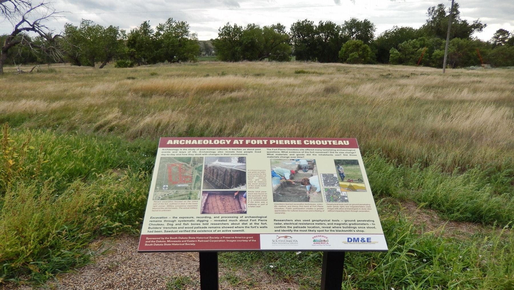
Archaeology at Fort Pierre Chouteau
Archaeology is the study of past human cultures. It teaches us about past events and ways of life. Archaeology also reveals how people lived day-to-day and how they dealt with changes in their environment.
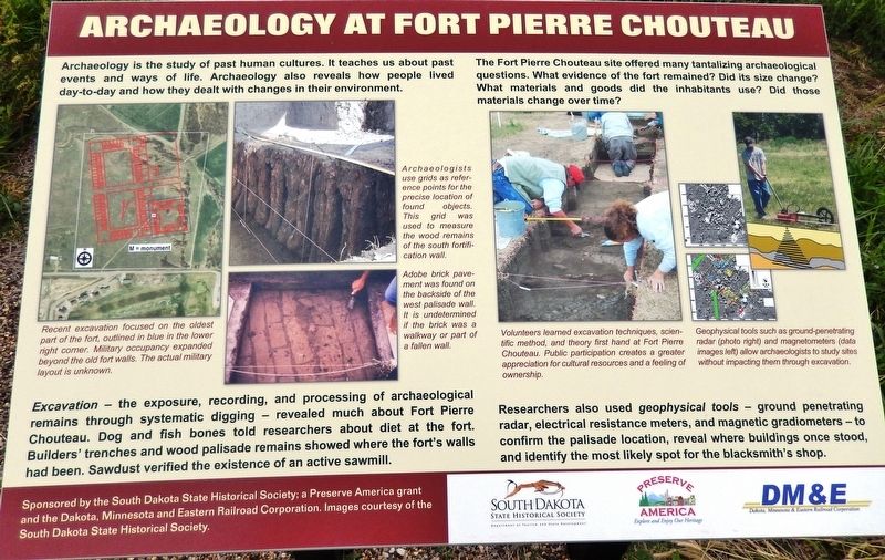
Excavation - the exposure, recording, and processing of archaeological remains through systematic digging - revealed much about Fort Pierre Chouteau. Dog and fish bones told researchers about diet at the fort. Builders' trenches and wood palisade remains showed where the fort's walls had been. Sawdust verified the existence of an active sawmill.
The Fort Pierre Chouteau site offered many tantalizing archaeological questions. What evidence of the fort remained? Did its size change? What materials and goods did the inhabitants use? Did those materials change over time?
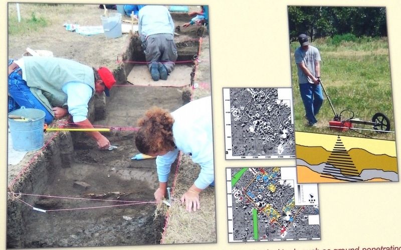
Researchers also used geophysical tools - ground penetrating radar, electrical resistance meters, and magnetic gradiometers - to confirm the palisade location, reveal where buildings once stood, and identify the most likely spot for the blacksmith's shop.
Images courtesy of the South Dakota Historical Society and the National Archives.
Erected by The South Dakota State Historical Society, a Preserve America grant and the Dakota, Minnesota and Eastern Railroad Corporation.
Topics. This historical marker is listed in these topic lists: Anthropology & Archaeology • Forts and Castles • Science & Medicine.
Location. 44° 23.453′ N, 100° 23.263′ W. Marker is in Fort Pierre, South Dakota, in Stanley County. Marker can be reached from Fort Chouteau Road, 0.3 miles east of State Highway 1806 when traveling east. Marker is located on the grounds of the Fort Pierre Chouteau National Historic Landmark, at the northeast end of the walking trail from Fort Chouteau Road. Touch for map. Marker is at or near this postal address: 350 Fort Chouteau Road, Fort Pierre SD 57532, United States of America. Touch for directions.
Other nearby markers. At least 8 other markers are within walking distance of this marker. Fort Pierre Chouteau Site (here, next to this marker); Fort Pierre Chouteau: Military Occupancy (1855-1857) (here, next to this marker); Fort Pierre Choteau Trading Post (here, next to this marker); Cultures Come Together (within shouting distance of this marker); Fort Pierre Chouteau: Fur Trade (1832-1855) (about 300 feet away, measured in a direct line); Fur Trade on the Upper Missouri River (about 500 feet away); Rivers and Trails

2. Marker detail: Recent excavation focused on the oldest pad of the fort
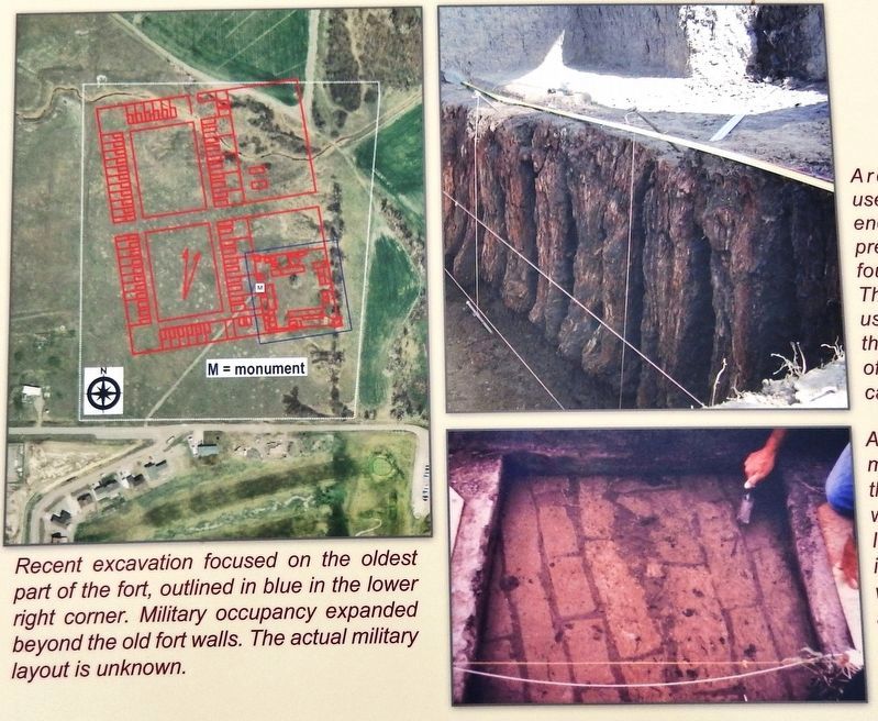
Recent excavation focused on the oldest pad of the fort, outlined in blue in the lower right corner. Military occupancy expanded beyond the old fort walls. The actual military layout is unknown.
Archaeologists use grids as reference points for the precise location of found objects. This grid was used to measure the wood remains of the south fortification wall.
Adobe brick pavement was found on the backside of the west palisade wall. It is undetermined if the brick was a walkway or part of a fallen wall.
More about this marker. Marker is a large composite plaque, mounted horizontally on waist-high metal posts.
Related markers. Click here for a list of markers that are related to this marker. Fort Pierre Chouteau National Historic Landmark

August 19, 2016
3. Marker detail: Archaeology at Fort Pierre Chouteau
Volunteers learned excavation techniques, scientific method, and theory first hand at Fort Pierre Chouteau. Public participation creates a greater appreciation for cultural resources and a feeling of ownership.
Geophysical tools such as ground-penetrating radar (photo right) and magnetometers (data images left) allow archaeologists to study sites without impacting them through excavation.
Geophysical tools such as ground-penetrating radar (photo right) and magnetometers (data images left) allow archaeologists to study sites without impacting them through excavation.
Credits. This page was last revised on June 7, 2021. It was originally submitted on October 9, 2018, by Cosmos Mariner of Cape Canaveral, Florida. This page has been viewed 170 times since then and 28 times this year. Photos: 1, 2, 3, 4. submitted on October 10, 2018, by Cosmos Mariner of Cape Canaveral, Florida. • Andrew Ruppenstein was the editor who published this page.

