LaFayette in Walker County, Georgia — The American South (South Atlantic)
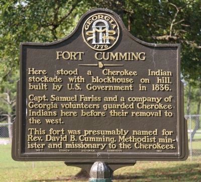
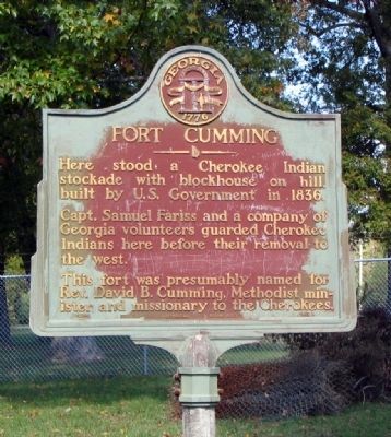
Fort Cumming
Capt. Samuel Fariss and a company of Georgia volunteers guarded Cherokee Indians here before their removal to the west.
This fort was presumably named for Rev. David B. Cumming, Methodist minister and missionary to the Cherokees.
Erected 1952 by Georgia Historical Commission. (Marker Number 146-1.)
Topics and series. This historical marker is listed in these topic lists: Forts and Castles • Native Americans • Wars, Non-US. In addition, it is included in the Georgia Historical Society, and the Trail of Tears series lists. A significant historical year for this entry is 1836.
Location. 34° 42.912′ N, 85° 17.289′ W. Marker is in LaFayette, Georgia, in Walker County. Marker is on W. Indiana Avenue near Part Street, on the right when traveling west. Touch for map. Marker is in this post office area: La Fayette GA 30728, United States of America. Touch for directions.
Other nearby markers. At least 8 other markers are within walking distance of this marker. Marsh-Warthen House (approx. 0.6 miles away); African American Pioneers of the Marsh-Warthen-Clements House (approx. 0.6 miles away); To Our Confederate Soldiers (approx. 0.6 miles away); Walker County (approx. 0.6 miles away); General LaFayette (approx. 0.6 miles away); The Battle of LaFayette (approx. 0.6 miles away); The Army of Tennessee (approx. 0.6 miles away); The Marsh House (approx. 0.6 miles away). Touch for a list and map of all markers in LaFayette.
Regarding Fort Cumming. Fort Cumming was a stockade that housed Cherokee Indians before their removal on the Trail of Tears. Nothing remains of the fort.
On December 29, 1835, at New Echota, the capital of the Cherokee Nation, some of the Cherokee leaders signed a treaty with the U.S. government agreeing to the removal of all Cherokees to the West. The Native Americans who signed the treaty also agreed to relinquish all Cherokee lands east of the Mississippi River.
The U.S. Senate ratified the treaty on May 23, 1836, and the Cherokees were given two years to leave Georgia. Many Cherokees did not recognize the New Echota Treaty and refused to leave their homes. Gen. Winfield Scott was charged with gathering together the Cherokees and removing them from Southeast.
Stockades were built to house the Cherokees until they could be removed to the West. Fort Cumming in LaFayette was one of
those stockades. Capt. Samuel Farris and a company of Georgia volunteers guarded the Cherokees until their removal. The fort is believed to have housed about 500 men, women and children. It was built in 1836 and named for David B. Cumming, a Methodist minister and missionary to the Cherokees.
The fort was a large enclosure of upright logs with a rifle tower in each corner. No photos or drawings of the structure have been found. The stockade with block house was built on a hill just above the area now known as Big Spring. Today the site is near the west end of Indiana Avenue.
(Source: James A Sartain’s History of Walker County, 1932, and This is Your Georgia, 1977, by Bernice McCullar and Sibley Jennings.)
Also see . . . Wikipedia entry for the Trail of Tears. The "removal to the west" mentioned on the marker was later referred to as the "Trail of Tears." (Submitted on October 24, 2008, by David Seibert of Sandy Springs, Georgia.)
Additional keywords. Trail of Tears, forced removal

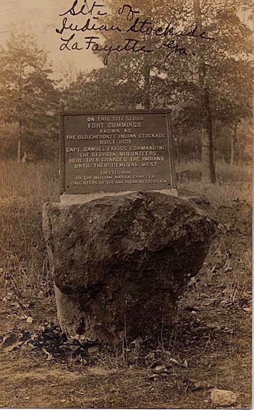
5. An additional, earlier Fort Cumming Marker
Site of Fort Cummings Indian Stockade, LaFayette, Georgia. Postcard by unknown creator. Courtesy of the Historic Postcards collection, Georgia Archives, University System of Georgia.
On this site stood Fort Cummings known as the Old Cherokee Indian Stockade built 1838
Capt. Samuel Fariss commanding the Georgia Volunteers here they guarded the Indians until their removal west
Erected … by the William Marsh Chapter Daughters of the American Revolution
On this site stood Fort Cummings known as the Old Cherokee Indian Stockade built 1838
Capt. Samuel Fariss commanding the Georgia Volunteers here they guarded the Indians until their removal west
Erected … by the William Marsh Chapter Daughters of the American Revolution
Credits. This page was last revised on August 26, 2020. It was originally submitted on October 23, 2008, by David Seibert of Sandy Springs, Georgia. This page has been viewed 1,899 times since then and 70 times this year. Photos: 1. submitted on April 28, 2015, by Dale K. Benington of Toledo, Ohio. 2. submitted on November 18, 2008, by David Seibert of Sandy Springs, Georgia. 3. submitted on April 28, 2015, by Dale K. Benington of Toledo, Ohio. 4. submitted on October 23, 2008, by David Seibert of Sandy Springs, Georgia. 5. submitted on December 7, 2018, by J. Makali Bruton of Accra, Ghana. • Kevin W. was the editor who published this page.


