San Luis Potosí, Mexico — The Northeast (and Central Highlands)
Royal Treasure / Monumental Palace
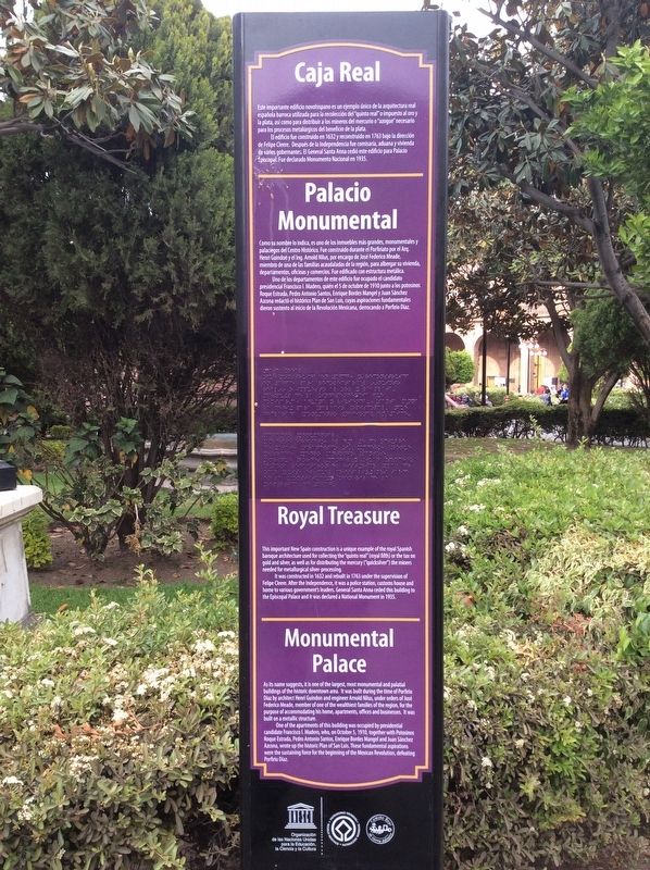
Este importante edificio novohispano es un ejemplo único de la arquitectura real española barroca utilizada para la recolección del “quinto real” o impuesto al oro y la plata, así como para distribuir a los mineros del mercurio o “azogue” necesario para los procesos metalúrgicos del beneficio de la plata.
El edificio fue construido en 1763 bajo la dirección de Felipe Cleere. Después de la Independencia fue comisaria, aduana y vivienda de varios gobernantes. El General Santa Anna cedió este edificio para Palacio Apiscopal. Fue declarado Monumento Nacional en 1935.
Palacio Monumental
Como su nombre lo indica, es uno de los inmuebles más grandes, monumentales y palaciegos del Centro Histórico. Fue construido durante el Porfriato por el Arq. Henri Guindon y el Ing. Arnold Nilus, por encargo de José Federico Meade, miembro de una de las familias acaudaladas de la región, para albergar su vivienda, departamentos, oficinas y comercios. Fue edificado con estructura metálica.
Uno de los departamentos de este edificio fue ocupado el candidato presidencial Francisco I. Madero, quién el 5 de octubre de 1910 junto a los potosinos Roque Estrada, Pedro Antonio Santos, Enrique Bordes Mangel y Juan Sánchez Azcona redactó el histórico Plan de San Luis, cuyas aspiraciones fundamentales dieron sustento al inicio de la Revolución Mexicana, derrocando a Porfirio Díaz.
Royal Treasure
This important New Spain construction is a unique example of the royal Spanish baroque architecture used for collecting the “quinto real” (royal fifth) or the tax on gold and silver, as well as for distributing the mercury (“quicksilver”) the miners needed for metallurgical silver-processing.
It was constructed in 1632 and rebuilt in 1763 under the supervision of Felipe Cleere. After the Independence, it was a police station, customs house and home to various government’s leaders. General Santa Anna ceded this building to the Episcopal Palace and it was declared a National Monument in 1935.
Monumental Palace
As its name suggests, it is one of the largest, most monumental and palatial buildings of the historic downtown area. It was built during the time of Porfirio Díaz by architect Henri Guindon and engineer Arnold Nilus, under orders of José Federico Meade, member of one of the wealthiest families of the region, for the purpose of accommodating his home, apartments, offices and businesses.

Photographed By J. Makali Bruton, March 16, 2019
2. Royal Treasure / Monumental Palace Marker
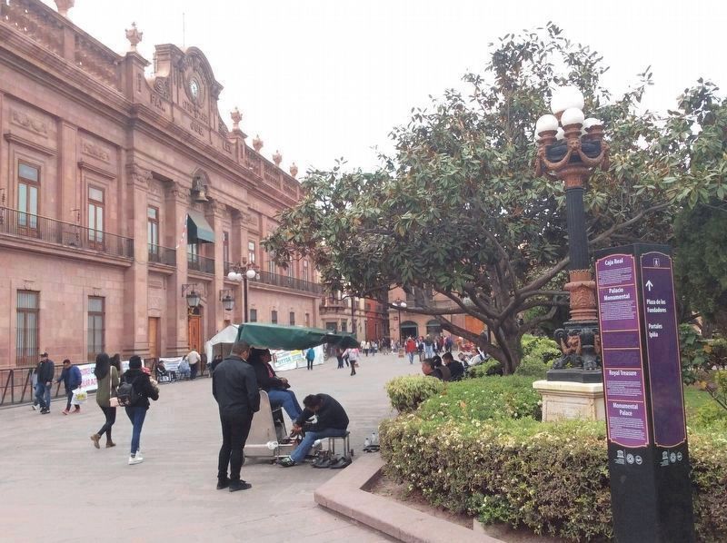
The marker can be seen here on the right, with the Palacio del Gobierno (Government Palace) in the background to the left. Note the commemorative lamppost directly to the left of the marker, dating from 1910 and the 100th anniversary celebration of Mexican Independence.
One of the apartments of this building was occupied by presidential candidate Francisco I. Madero, who, on October 5, 1910, together with Potosinos Roque Estrada, Pedro Antonio Santos, Enrique Bordes Mangel and Juan Sánchez Azcona, wrote up the historic Plan of San Luis. These fundamental aspirations were the sustaining force for the beginning of the Mexican Revolution, defeating Porfirio Díaz.
Erected by United Nations Educational, Scientific and Cultural Organization (UNESCO), Camino Real de Tierra Adentro.
Topics. This historical marker is listed in these topic lists: Architecture • Colonial Era • Industry & Commerce • Man-Made Features. A significant historical date for this entry is October 5, 1910.
Location. 22° 9.086′ N, 100° 58.596′ W. Marker is in San Luis Potosí. Marker is on Jardín Hidalgo just north of Francisco I. Madero, on the right when traveling north. Touch for map. Marker is in this post office area: San Luis Potosí 78000, Mexico. Touch for directions.
Other nearby markers. At least 8 other markers are within walking distance of this marker. Government Palace (within shouting distance of this marker); Metropolitan Cathedral / Vicereine's Balcony (within shouting distance of this marker); Government Palace / Vicereine’s House (within shouting distance of this marker); Arms Square / City Hall (within shouting

Photographed By J. Makali Bruton, March 16, 2019
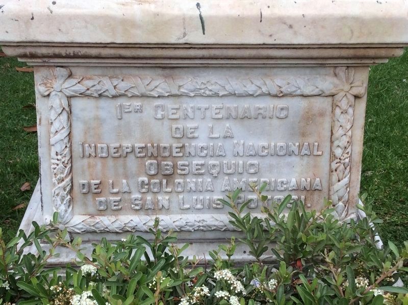
3. A nearby memorial to the 100th anniversary of Mexican Independence
This nearby memorial lamppost is repeated on the other corners of the park. It reads:
1er Centenario de la Independencia Nacional obsequio de la colonia americana de San Luis Potosi.
English translation: 100th anniversary of National Independence, a gift from the citizens of the United States of America resident in San Luis Potosí.
Credits. This page was last revised on April 10, 2019. It was originally submitted on April 9, 2019, by J. Makali Bruton of Accra, Ghana. This page has been viewed 103 times since then and 15 times this year. Photos: 1, 2, 3. submitted on April 9, 2019, by J. Makali Bruton of Accra, Ghana. 4. submitted on April 10, 2019, by J. Makali Bruton of Accra, Ghana.

