Carillon in Richmond, Virginia — The American South (Mid-Atlantic)
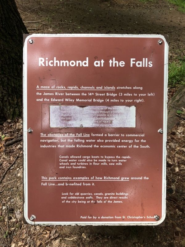
Richmond at the Falls
A maze of rocks, rapids, channels and islands stretches along the James River between the 14th Street Bridge (3 miles to your left) and the Edward Wiley Memorial Bridge (4 miles to your right).
It is called the Fall Line because of the way the river drops steeply as it cuts through a band of underlying hard rock. That granite is a scar from the collision of Africa and North America 300 million years ago. The band of rock actually extend 1000 miles from New Jersey to Georgia.
The obstacles of the Fall Line formed a barrier to commercial navigation, but the falling water also provided energy for the industries that made Richmond the economic center of the South.
Canals allowed cargo boats to bypass the rapids. Canal water could also be made to turn water wheels and turbines in flour mills, saw mills and iron foundries.
This park contains examples of how Richmond grew around the Fall Line...and benefited from it.
Look for old quarries, canals, granite buildings and cobblestone walls. They are all direct results of the city being at the falls of the James.
Erected by St. Christopher's School.
Topics. This historical marker is listed in these topic lists: Industry & Commerce • Settlements & Settlers • Waterways & Vessels.
Location. 37° 32.234′ N, 77° 29.158′ W. Marker is in Richmond, Virginia. It is in Carillon. Marker is on Pump House Drive east of James Falls Drive, on the right when traveling east. Touch for map. Marker is at or near this postal address: 1600 Pump House Drive, Richmond VA 23225, United States of America. Touch for directions.
Other nearby markers. At least 8 other markers are within walking distance of this marker. Breaking Stones with Feathers (a few steps from this marker); Byrd Park Pump House (within shouting distance of this marker); Mule-Fueled Waterway (about 300 feet away, measured in a direct line); Pumps and Parties (about 300 feet away); Water Water Everywhere (about 700 feet away); River & Canal (approx. 0.4 miles away); The Carillon (approx. 0.4 miles away); Maymont, Gilded Age Estate (approx. half a mile away). Touch for a list and map of all markers in Richmond.
Credits. This page was last revised on February 1, 2023. It was originally submitted on May 11, 2019, by Devry Becker Jones of Washington, District of Columbia. This page has been viewed 313 times since then and 39 times this year. Photos: 1, 2. submitted on May 11, 2019, by Devry Becker Jones of Washington, District of Columbia.

