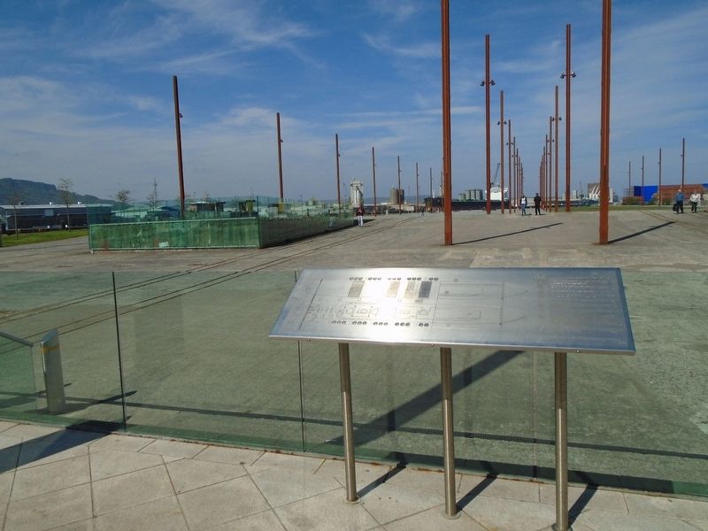
Titanic and Olympic Slipways
KEY
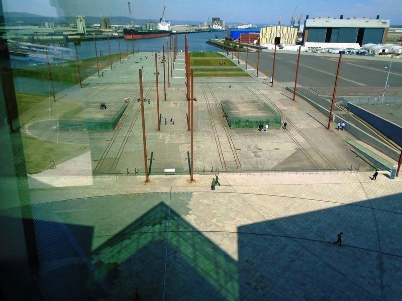
(1) (2) The illuminated blue lines demonstrate the actual size and location of the Titanic (1) and Olympic (2) ships constructed on these two Slipways.
(3) The turfed and decked areas denote the proportions of people that survived (decked) and died (turfed) as a result of the Titanic disaster. This area represents the First Class passengers.
(4) This area represents the Second Class passengers. With each drop in class, there are fewer survivors and more victims of the disaster.
(5) This area represents the Third Class passengers.
(6) Often overlooked when discussing the victims of that fateful voyage this area represents those crew that died and survived.
(7) Part of the top deck plan of the Titanic is depicted in White granite lines.
(8) The original Slipways, exposed here, were cast at a continuous gradient down towards the sea and the prows of the ships were supported on these two concrete wedges.
(9) These are the original bogey rails, used to transport materials and tools up and down the slipways during construction.
(10) The textured granite rectangle replicates the position of the concrete blocks which formed the foundations for the massive gantry stanchions. The steel plates in the corners indicate the footprint of the
gantry stanchions. Adjacent the steel columns provide a part vertical representation of the Arrol Gantry which encased the two ships during construction. The original gantry structure reached 69m, more than 3 times the height of the posts displayed.
(11) The concrete piers at the end of the slipways contained machinery to pump out the water behind the Cassons which formed a temporary dam during construction of the ship hulls.
Topics. This historical marker is listed in these topic lists: Disasters • Industry & Commerce • Man-Made Features • Waterways & Vessels.
Location. 54° 36.52′ N, 5° 54.576′ W. Marker is in Belfast, Northern Ireland. Marker is adjacent to the Titanic Belfast museum. Touch for map. Marker is at or near this postal address: 1 Olympic Way, Queen's Road, Belfast, Northern Ireland BT3 9EP, United Kingdom. Touch for directions.
Other nearby markers. At least 8 other markers are within walking distance of this marker. Olympic Slipway (within shouting distance of this marker); Titanic Slipway (within shouting distance of this marker); RMS Titanic Keel Laying Centenary (within shouting distance of this marker); Shipbuilding & Mapmaking [Part 1] (within shouting distance of this marker); Shipbuilding & Mapmaking [Part 2] (about 90 meters away, measured in a direct line); Former Harland & Wolff Headquarter Building
Also see . . .
1. Harland and Wolff at Wikipedia. (Submitted on June 7, 2019, by William Fischer, Jr. of Scranton, Pennsylvania.)
2. Titanic Belfast. (Submitted on June 7, 2019, by William Fischer, Jr. of Scranton, Pennsylvania.)
Credits. This page was last revised on August 19, 2020. It was originally submitted on June 7, 2019, by William Fischer, Jr. of Scranton, Pennsylvania. This page has been viewed 330 times since then and 40 times this year. Photos: 1, 2. submitted on June 7, 2019, by William Fischer, Jr. of Scranton, Pennsylvania. 3. submitted on June 4, 2019, by William Fischer, Jr. of Scranton, Pennsylvania.


