Near North Riverfront in St. Louis, Missouri — The American Midwest (Upper Plains)
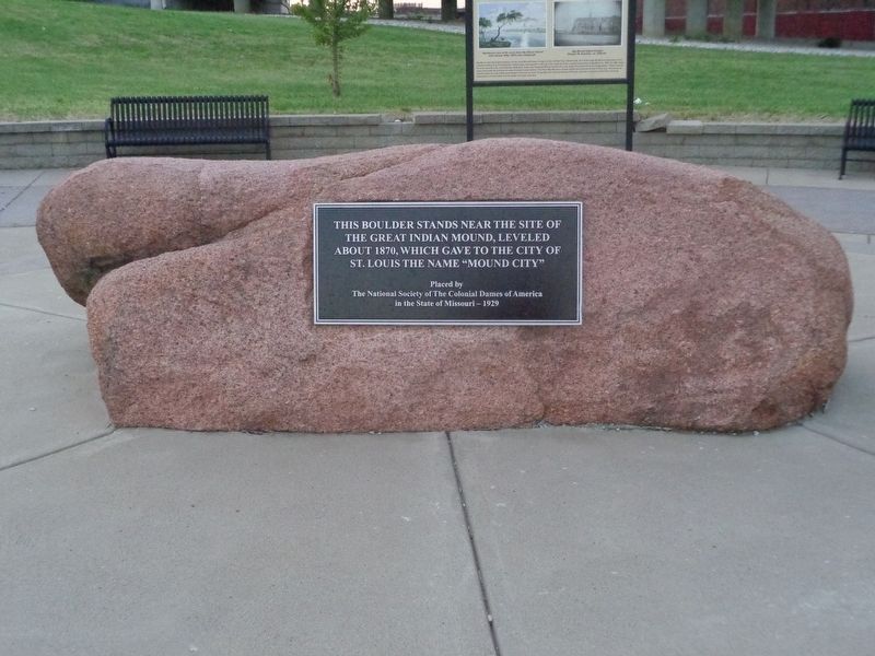
Le Grange de Terre (Big Mound)
Erected 1929 by The National Society of The Colonial Dames of America in the State of Missouri.
Topics and series. This historical marker is listed in these topic lists: Anthropology & Archaeology • Native Americans. In addition, it is included in the The Colonial Dames of America, National Society of series list.
Location. 38° 38.589′ N, 90° 11.105′ W. Marker is in St. Louis, Missouri. It is in Near North Riverfront. Marker is on Mound Street, on the left when traveling east. Touch for map. Marker is at or near this postal address: 1700 North Broadway, Saint Louis MO 63102, United States of America. Touch for directions.
Other nearby markers. At least 8 other markers are within walking distance of this marker. Mounds Heritage Trail (a few steps from this marker); Fr. Edward S. Filipiak Park (approx. 0.6 miles away); Biddle Street Trailhead (approx. 0.6 miles away); AMDG Shrine of St. Joseph (approx. 0.6 miles away); 1993 (approx. 0.8 miles away); 1992 (approx. 0.8 miles away); 1991 (approx. 0.8 miles away); Robert J. Baer Plaza (approx. 0.8 miles away). Touch for a list and map of all markers in St. Louis.
More about this marker. This marker and memorial were originally placed where the Stan Musial Veteran's Memorial bridge stands now. The bridge opened in 2014.
Regarding Le Grange de Terre (Big Mound). As the marker says, St. Louis was nicknamed "Mound City" and the biggest of the 27 mounds found on the west side of the Mississippi River once stood at that spot. The mound stood approximately 30 feet high. When the French first claimed the city, they named the mound, "Le Grange de Terre", which in English means "Earthen barn". The mound was torn down as the city of St. Louis grew rapidly in the mid-19th century. Dirt and rocks were used as back fill and for making bricks for the roads.
Also see . . . The Big Mound of St. Louis. From the history blog, Distilled History, this tells the story about the "Big Mound" that was once in St. Louis. (Submitted on September 10, 2019, by Jason Voigt of Glen Carbon, Illinois.)
Credits. This page was last revised on January 30, 2023. It was originally submitted on September 10, 2019, by Jason Voigt of Glen Carbon, Illinois. This page has been viewed 568 times since then and 100 times this year. Photos: 1, 2. submitted on September 10, 2019, by Jason Voigt of Glen Carbon, Illinois. • Andrew Ruppenstein was the editor who published this page.

