North Brookhaven in Atlanta in DeKalb County, Georgia — The American South (South Atlantic)
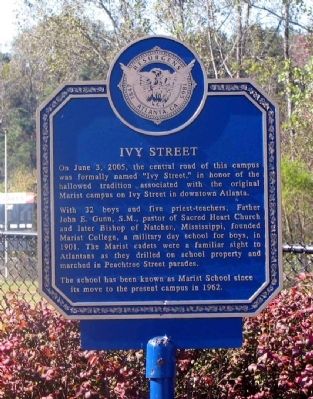
Ivy Street
With 32 boys and five priest-teachers, Father John E. Gunn, S.M., pastor of Sacred Heart Church and later Bishop of Natchez, Mississippi, founded Marist College, a military day school for boys, in 1901. The Marist cadets were a familiar sight to Atlantans as they drilled on school property and marched in Peachtree Street parades.
The school has been known as Marist School since its move to the present campus in 1962.
Erected 2005 by Marist School.
Topics. This historical marker is listed in these topic lists: Churches & Religion • Education • Roads & Vehicles. A significant historical month for this entry is June 1894.
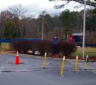
Location. 33° 54.067′ N, 84° 20.15′ W. Marker is in Atlanta, Georgia, in DeKalb County. It is in North Brookhaven. Marker is on "Ivy Street" drive on Marist Campus, 0.1 miles west of Ashford-Dunwoody Road, on the right when traveling west. The Marker is located at the end of Ivy Street, the drive through the Marist campus, at the circle in front of Centennial Center. Touch for map. Marker is at or near this postal address: 3790 Ashford-Dunwoody Road, Atlanta GA 30319, United States of America. Touch for directions.
Other nearby markers. At least 8 other markers are within 3 miles of this marker, measured as the crow flies. Dodge's 16th A.C. Camp on Nancy's Creek (approx. 0.3 miles away); Old Cross Keys (approx. 0.9 miles away); Hascall's Div. Joins Cox's Line of March (approx. 1.3 miles away); The Samuel House Plantation (approx. 1.8 miles away); Oglethorpe University (approx. 1.9 miles away); Logan's & Blair's Camp Nancy's Creek (approx. 2.3 miles away); 1917 ✯ Camp Gordon ✯ 1919 (approx. 2˝ miles away); 1941 ✯ Naval Air Station Atlanta ✯ 1959 (approx. 2˝ miles away). Touch for a list and map of all markers in Atlanta.
Credits. This page was last revised on February 8, 2023. It was originally submitted on December 5, 2008, by David Seibert of Sandy Springs, Georgia. This page has been viewed 1,382 times since then and 48 times this year. Last updated on December 7, 2008, by David Seibert of Sandy Springs, Georgia. Photos: 1. submitted on December 5, 2008, by David Seibert of Sandy Springs, Georgia. 2. submitted on December 11, 2008, by David Seibert of Sandy Springs, Georgia. • Kevin W. was the editor who published this page.

