Jackson Township near Sunbury in Northumberland County, Pennsylvania — The American Northeast (Mid-Atlantic)
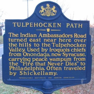
Tulpehocken Path
The Indian Ambassadors Road turned east near here over the hills to the Tulpehocken Valley. Used by Iroquois chiefs from Onondaga, now Syracuse, carrying peace wampum from the "Fire that Never Dies" to Philadelphia. Often traveled by Shickellamy.
Erected 1950 by Pennsylvania Historical and Museum Commission.
Topics and series. This historical marker is listed in these topic lists: Colonial Era • Native Americans. In addition, it is included in the Pennsylvania Historical and Museum Commission series list.
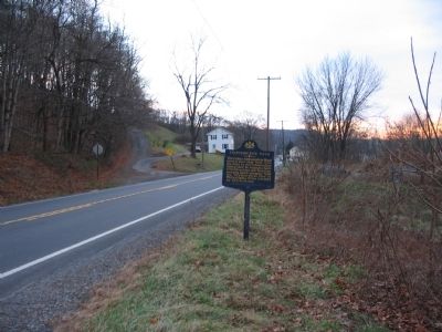
Location. 40° 43.294′ N, 76° 50.251′ W. Marker is near Sunbury, Pennsylvania, in Northumberland County. It is in Jackson Township. Marker is on State Street (State Highway 147), on the right when traveling south. Touch for map. Marker is at or near this postal address: 147 State St, Sunbury PA 17801, United States of America. Touch for directions.
Other nearby markers. At least 8 other markers are within 6 miles of this marker, measured as the crow flies. Herndon (approx. ¼ mile away); John Scull Trading Post (approx. half a mile away); Herndon Formerly Trevorton Junction (approx. 0.9 miles away); Line Mountain A.K.A. Mahanoy Mountain (approx. 1.3 miles away); Mandata (approx. 2.6 miles away); Simon Snyder (approx. 4.9 miles away); Veterans Memorial (approx. 5.1 miles away); Erected to the Memory of Simon Snyder (approx. 5.4 miles away).
Also see . . . The Tulpehocken Path. Lykes Valley website entry (Submitted on September 4, 2022, by Larry Gertner of New York, New York.)
Credits. This page was last revised on February 7, 2023. It was originally submitted on December 13, 2008, by Craig Swain of Leesburg, Virginia. This page has been viewed 1,213 times since then and 19 times this year. Photos: 1, 2. submitted on December 13, 2008, by Craig Swain of Leesburg, Virginia.

