Richmond in Chesterfield County, Virginia — The American South (Mid-Atlantic)
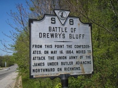
Battle of Drewry’s Bluff
Erected 1930 by Conservation & Development Commission. (Marker Number S-8.)
Topics and series. This historical marker is listed in this topic list: War, US Civil. In addition, it is included in the Virginia Department of Historic Resources (DHR) series list. A significant historical month for this entry is May 1927.
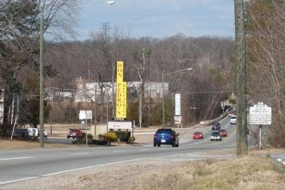
Location. 37° 24.309′ N, 77° 25.982′ W. Marker is in Richmond, Virginia, in Chesterfield County. Marker is on Jefferson Davis Hwy (U.S. 1 / 301), on the right when traveling north. Marker is on Route 1, about 4 miles south of Richmond between Bellwood Road and Norcliff Road. . Touch for map. Marker is in this post office area: Richmond VA 23237, United States of America. Touch for directions.
Other nearby markers. At least 8 other markers are within walking distance of this marker. Drewry’s Bluff Defences (about 600 feet away, measured in a direct line); The Bermuda Campaign (approx. 0.2 miles away); Fort Stevens (approx. ¼ mile away); a different marker also named Fort Stevens (approx. ¼ mile away); First Virginia Infantry Regiment (approx. ¼ mile away); Bellwood Elk Herd (approx. 0.6 miles away); Drewry’s Bluff Battlefield (approx. 0.6 miles away); Second Battle of Drewry's Bluff (approx. 0.6 miles away). Touch for a list and map of all markers in Richmond.
Also see . . . Battle of Drewry’s Bluff, 15 May 1862. Account from the American Civil War website of a Battle at Drewry's Bluff that occured two years before the battle noted on the marker. (Submitted on December 31, 2008, by Bill Coughlin of Woodland Park, New Jersey.)
Credits. This page was last revised on June 16, 2016. It was originally submitted on December 31, 2008, by Bill Coughlin of Woodland Park, New Jersey. This page has been viewed 1,561 times since then and 56 times this year. Photos: 1. submitted on December 31, 2008, by Bill Coughlin of Woodland Park, New Jersey. 2. submitted on February 10, 2009, by Bernard Fisher of Richmond, Virginia. 3, 4. submitted on December 31, 2008, by Bill Coughlin of Woodland Park, New Jersey.


