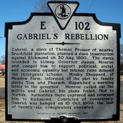
Near Richmond in Henrico County, Virginia — The American South (Mid-Atlantic)
Gabriel's Rebellion
Erected 1997 by Department of Historic Resources. (Marker Number E-102.)
Topics and series. This historical marker is listed in these topic lists: African Americans • Notable Events. In addition, it is included in the Former U.S. Presidents: #05 James Monroe, and the Virginia Department of Historic Resources (DHR) series lists. A significant historical date for this entry is August 30, 1800.
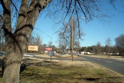
Location. 37° 36.943′ N, 77° 27.421′ W. Marker is near Richmond, Virginia, in Henrico County. Marker is on Brook Turnpike (U.S. 1) 0.1 miles south of Hilliard Road, in the median. Touch for map. Marker is in this post office area: Richmond VA 23227, United States of America. Touch for directions.
Other nearby markers. At least 8 other markers are within walking distance of this marker. Outer Fortifications (approx. 0.3 miles away); Campaign of 1781 (approx. 0.3 miles away); Richmond Defences (approx. 0.3 miles away); Brook Road (approx. 0.3 miles away); Confederate Fortifications (approx. 0.3 miles away); The Fort Under Attack (approx. 0.3 miles away); Stuart's Ride (approx. 0.3 miles away); Gabriel’s Insurrection (approx. 0.3 miles away). Touch for a list and map of all markers in Richmond.
Also see . . .
1. Meadow Farm. "Mosby Sheppard, of Meadow Farm, informed of the plot by family slaves Tom and Pharaoh, dispatched a warning letter to the governor." (Submitted on February 4, 2009.)
2. Gabriel’s Rebellion. Henrico County (Submitted on November 22, 2009.)
3. Gabriel's Conspiracy 1799-1800. PBS – Africans in America (Submitted on November 22, 2009.)
Credits. This page was last revised on November 5, 2021. It was originally submitted on February 4, 2009, by Bernard Fisher of Richmond, Virginia. This page has been viewed 2,511 times since then and 87 times this year. Photos: 1, 2. submitted on February 4, 2009, by Bernard Fisher of Richmond, Virginia. 3. submitted on November 22, 2009. • Christopher Busta-Peck was the editor who published this page.


