Marker Logo HMdb.org THE HISTORICAL
MARKER DATABASE
“Bite-Size Bits of Local, National, and Global History”
Near Richmond in Henrico County, Virginia — The American South (Mid-Atlantic)
 

Second Battle of Deep Bottom


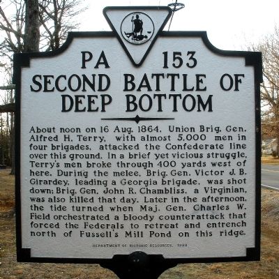
Second Battle of Deep Bottom Marker image. Click for full size.
Photographed By Bernard Fisher, February 17, 2009
1. Second Battle of Deep Bottom Marker
Inscription. About noon on 16 Aug. 1864, Union Brig. Gen. Alfred H. Terry, with almost 5,000 men in four brigades, attacked the Confederate line over this ground. In a brief yet vicious struggle, Terry's men broke through 400 yards west of here. During the melee, Brig. Gen. Victor J. B. Girardey, leading a Georgia brigade, was shot down; Brig. Gen. John R. Chambliss, a Virginian, was also killed that day. Later in the afternoon, the tide turned when Maj. Gen. Charles W. Field orchestrated a bloody counterattack that forced the Federals to retreat and entrench north of Fussell's Mill Pond on this ridge.
 
Erected 1998 by Department of Historic Resources. (Marker Number PA-153.)
 
Topics and series. This historical marker is listed in this topic list: War, US Civil. In addition, it is included in the Battlefield Trails - Civil War series list. A significant historical date for this entry is August 16, 1864.
 
Location. 37° 27.017′ N, 77° 16.954′ W. Marker is near Richmond, Virginia, in Henrico County. Marker is at the intersection of Darbytown Road and Fussells Ridge Drive, on the right when traveling east on Darbytown Road. Touch for map. Marker is in this post office area: Henrico VA 23231, United States of America. Touch for directions.
 
Other nearby markers. At least 8 other markers are within 3 miles of this marker, measured as the crow flies. 39th Illinois Veteran Volunteers (approx. ¼ mile away); 48th Alabama Regiment Monument
Paid Advertisement
Click on the ad for more information.
Please report objectionable advertising to the Editor.
Click or scan to see
this page online
(approx. 0.4 miles away); Darby House (approx. 1½ miles away); Gravel Hill (approx. 1.7 miles away); Sad Reunion (approx. 1.7 miles away); Pleasants v. Pleasants (approx. 2 miles away); Frazier's Farm (approx. 2 miles away); New Market Road (approx. 2.1 miles away). Touch for a list and map of all markers in Richmond.
 
Related markers. Click here for a list of markers that are related to this marker. Second Deep Bottom battlefield by markers.
 
Also see . . .
1. The Battle of Second Deep Bottom. American Battlefield Trust (Submitted on November 29, 2009.) 

2. Richmond Battlefields Association. This local battlefield preservation group has saved 60 acres of the Second Deep Bottom Battlefield (Fussell's Mill). (Submitted on November 29, 2009.) 
 
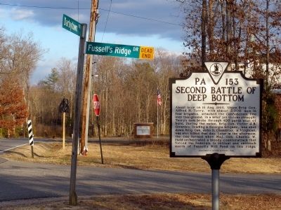
Darbytown Rd & Fussells Ridge Dr. image. Click for full size.
Photographed By Bernard Fisher, February 17, 2009
2. Darbytown Rd & Fussells Ridge Dr.
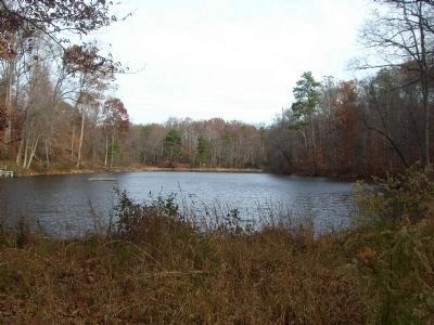
Fussell's Mill Pond. image. Click for full size.
Photographed By Bernard Fisher, December 1, 2007
3. Fussell's Mill Pond.
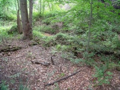
Site of Fussell's Mill. image. Click for full size.
Photographed By Bernard Fisher, June 13, 2009
4. Site of Fussell's Mill.
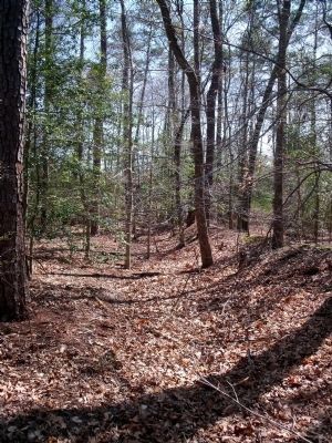
Confederate earthworks at Fussell's Mill. image. Click for full size.
Photographed By Bernard Fisher, April 5, 2009
5. Confederate earthworks at Fussell's Mill.
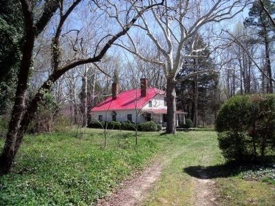
Period dwelling at Fussell's Mill. image. Click for full size.
Photographed By Bernard Fisher, April 5, 2009
6. Period dwelling at Fussell's Mill.
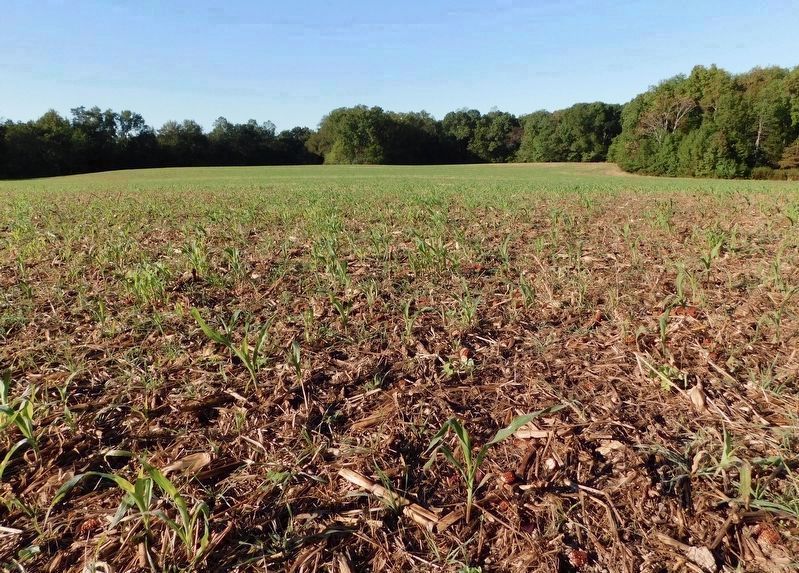
Site of a Portion of Second Deep Bottom Battlefield image. Click for full size.
Photographed By Bradley Owen, October 18, 2021
7. Site of a Portion of Second Deep Bottom Battlefield
Located at the south end of Mansfield Woods Drive (east of the marker location), Union and Confederate forces clashed in this field protected by the American Battlefield Trust.
 
 
Credits. This page was last revised on November 23, 2021. It was originally submitted on February 16, 2009, by Bernard Fisher of Richmond, Virginia. This page has been viewed 3,200 times since then and 61 times this year. Photos:   1, 2. submitted on February 16, 2009, by Bernard Fisher of Richmond, Virginia.   3, 4, 5, 6. submitted on June 28, 2009, by Bernard Fisher of Richmond, Virginia.   7. submitted on November 10, 2021, by Bradley Owen of Morgantown, West Virginia. • Craig Swain was the editor who published this page.
Share this page.  
Share on Tumblr
m=16179

CeraNet Cloud Computing sponsors the Historical Marker Database.
This website earns income from purchases you make after using our links to Amazon.com. We appreciate your support.
Paid Advertisement
Apr. 26, 2024